
Strong thunderstorms, gusty winds, and light snow are all possible in Marion County over the next 24 hours.
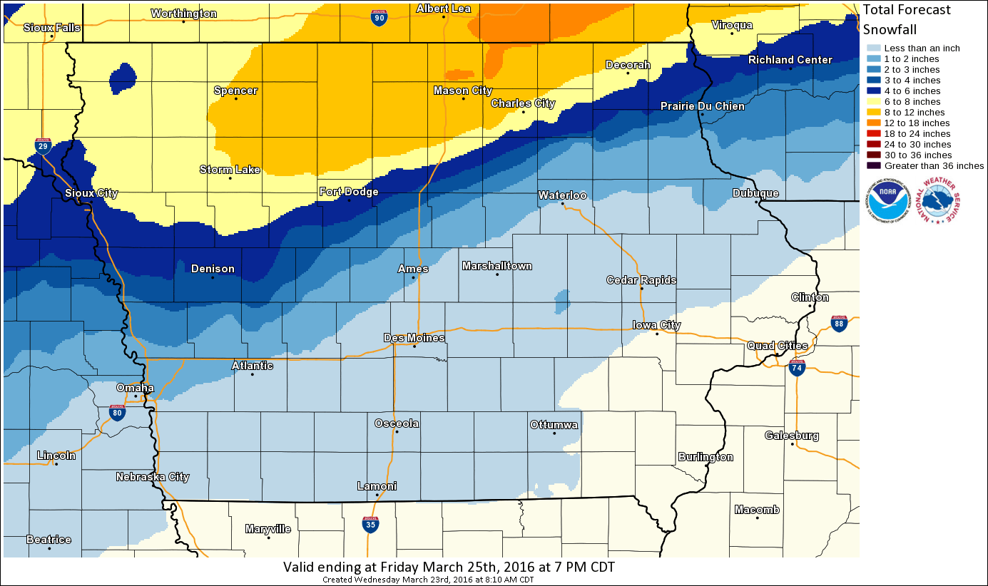
A late-season winter storm will push through the state later today, with rain moving in during the afternoon and a thunderstorm is possible by midnight. Precipitation will change over to snow during the overnight, with trace amounts up to an inch possible, which may cause a slick commute Thursday morning.
The heaviest snow is likely in northern Iowa, with up to a foot possible along and north of U.S. Highway 18.
A cooldown is expected to persist over the next few days as temperatures barely hit 40 on Wednesday, with highs topping out in the low 50s and upper 40s through Sunday.