
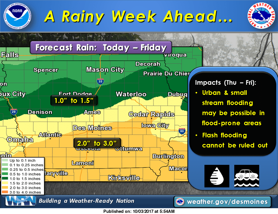
Periodic showers and thunderstorms are possible through the end of the week, which may provide much-needed precipitation throughout the state.
According to the National Weather Service, 2-3″ of rainfall is in the forecast by Saturday morning, with locally higher amounts possible. The first round is expected this evening, and increased chances of multiple showers are in place all day Thursday and Friday. Low-lying urban areas and lands, as well as small streams may experience flooding by the end of the week.
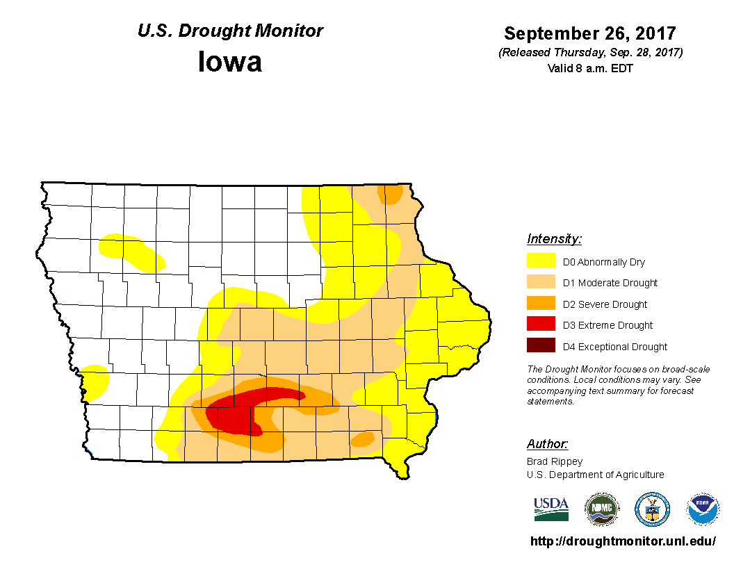
The latest U.S. Drought Monitor shows extreme drought (D3) conditions in portions of central Marion County, with severe drought in place throughout the rest of the region. According to the National Weather Service Palmer Drought Severity Index, 9 to 12 inches of rainfall is needed over a four-week period to break through the current drought.
Stay tuned to KNIA/KRLS for the latest weather information.