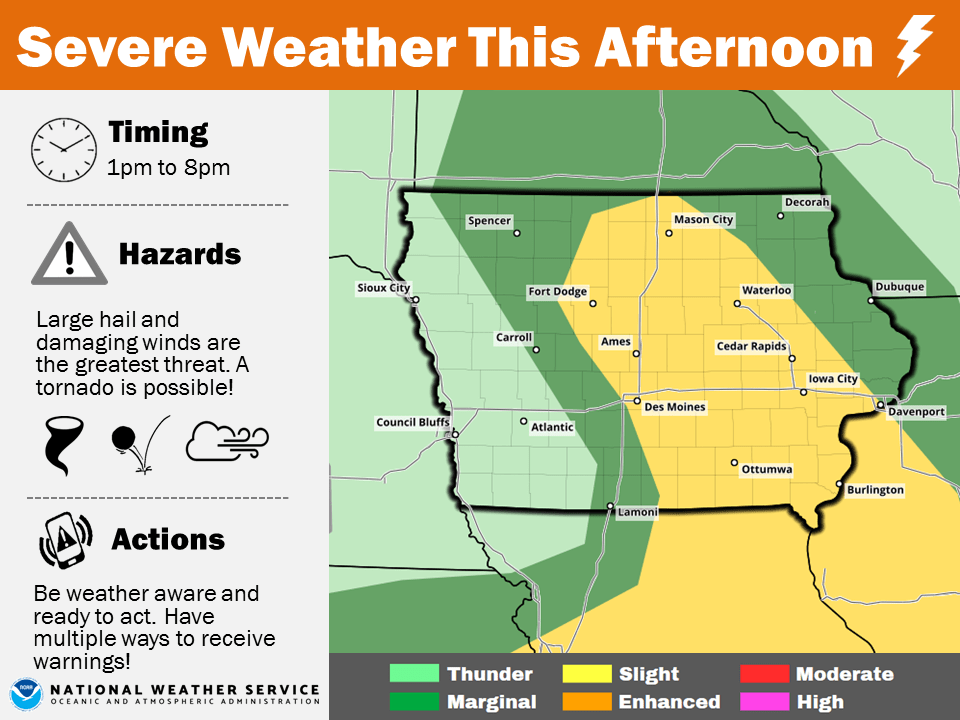
A slight risk for severe thunderstorms returns to south central Iowa today.
The National Weather Service Storm Prediction Center indicates storms this afternoon and evening will be capable of producing large hail and damaging winds, primarily in areas east of I-35. KNIA/KRLS is on the air live with Severe Weather Action Team coverage for any severe thunderstorm or tornado warning for any portion of Marion County, with backup generators ensuring the coverage stays on if the power goes out.
Rainfall totals (as of 9 a.m.):
Pella (KNIA/KRLS) – .37″
Knoxville (KNIA/KRLS) – .22″
Lake Red Rock – .25″
Des Moines River near Tracy – .19″
Cedar Creek near Bussey – .27″
