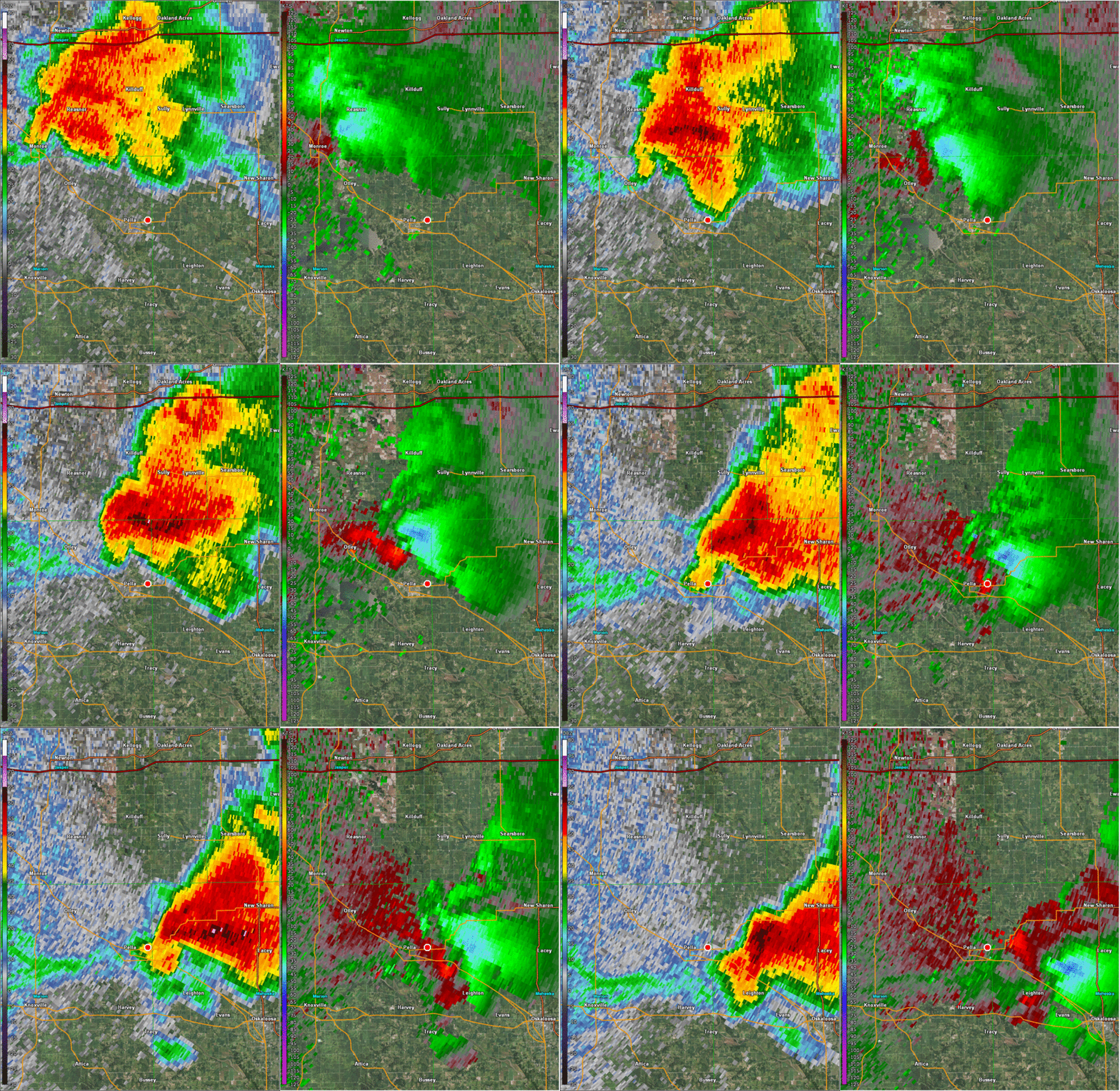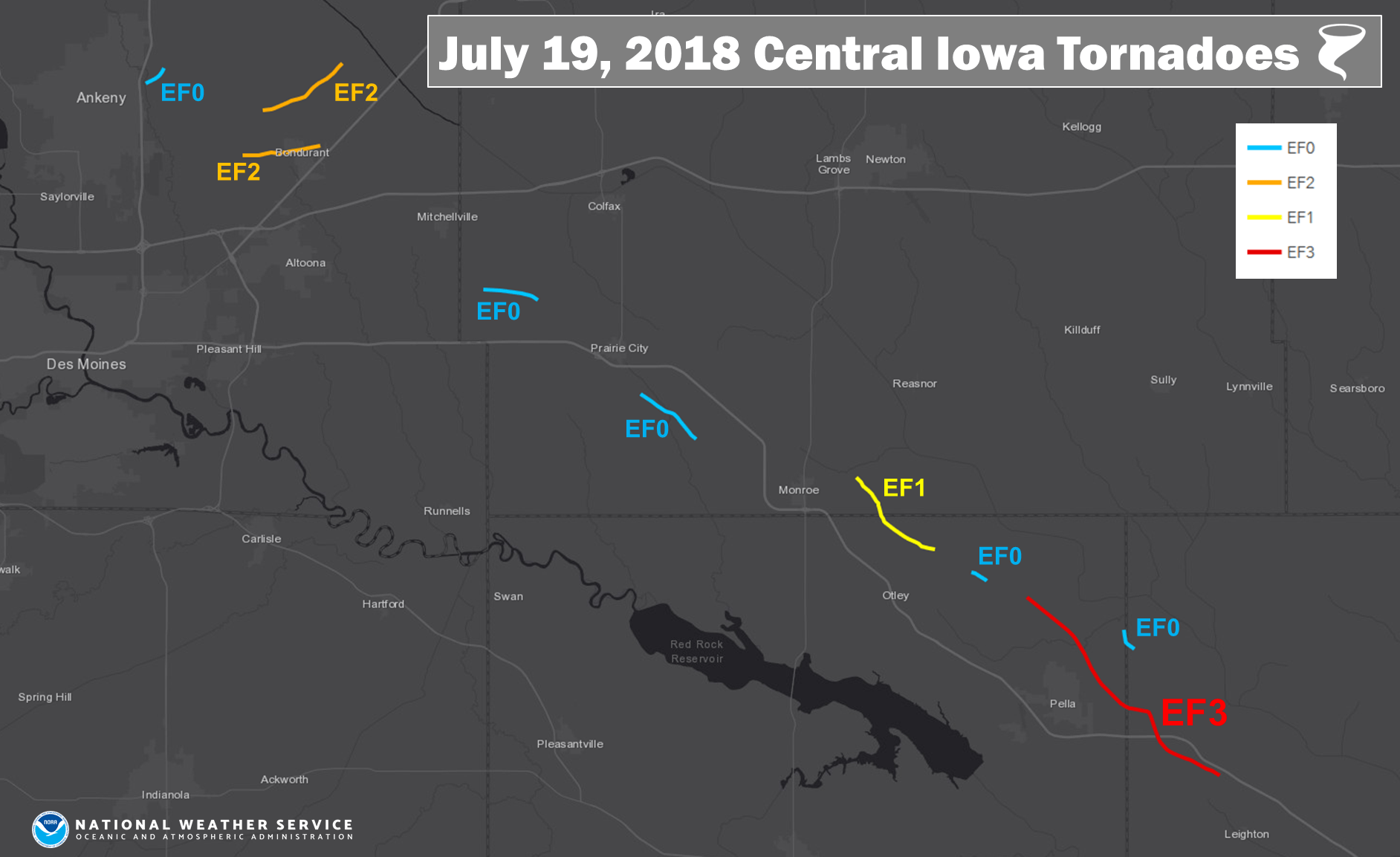
Click image above to enlarge
The National Weather Service has confirmed 13 tornadoes hit central Iowa on July 19th.
According to their storm survey, an EF-3 rated storm traveled approximately 10 miles from three miles north of Pella all the way to rural Mahaska County south of Highway 163. It was on the ground from 4:03 to 4:27 p.m. and had a maximum width of 400 yards.
Video from the Iowa Environmental Mesonet.
The tornado intensified as it crossed 228th Place near Thunder Ridge Road, where it caused crop, tree, and structural damage to numerous rural areas just northeast of Pella, including sliding a house off of its foundation. The storm had an estimated peak wind speed of 144 MPH when it tore through the Vermeer Mile.

The KNIA/KRLS Severe Weather Action Team was on the air for the duration of the storm, providing live updates to the location of the tornado and airing numerous live updates from staff and listeners in the Pella area.
In total, 13 tornadoes were confirmed to be on the ground July 19th, with two rated EF-3 (including the storm in Marshalltown), two EF-2, one EF-1, and one EF-0. Touch downs were reported near Monroe and Prairie City as well.
Stay tuned to KNIA/KRLS for the latest severe weather information. Click here for more details (National Weather Service).
Map of Tornadoes along Highway 163, I-80 Corridors:


