Winter continues to have its grasp on Iowa, with another round of arctic cold and snow on the way.
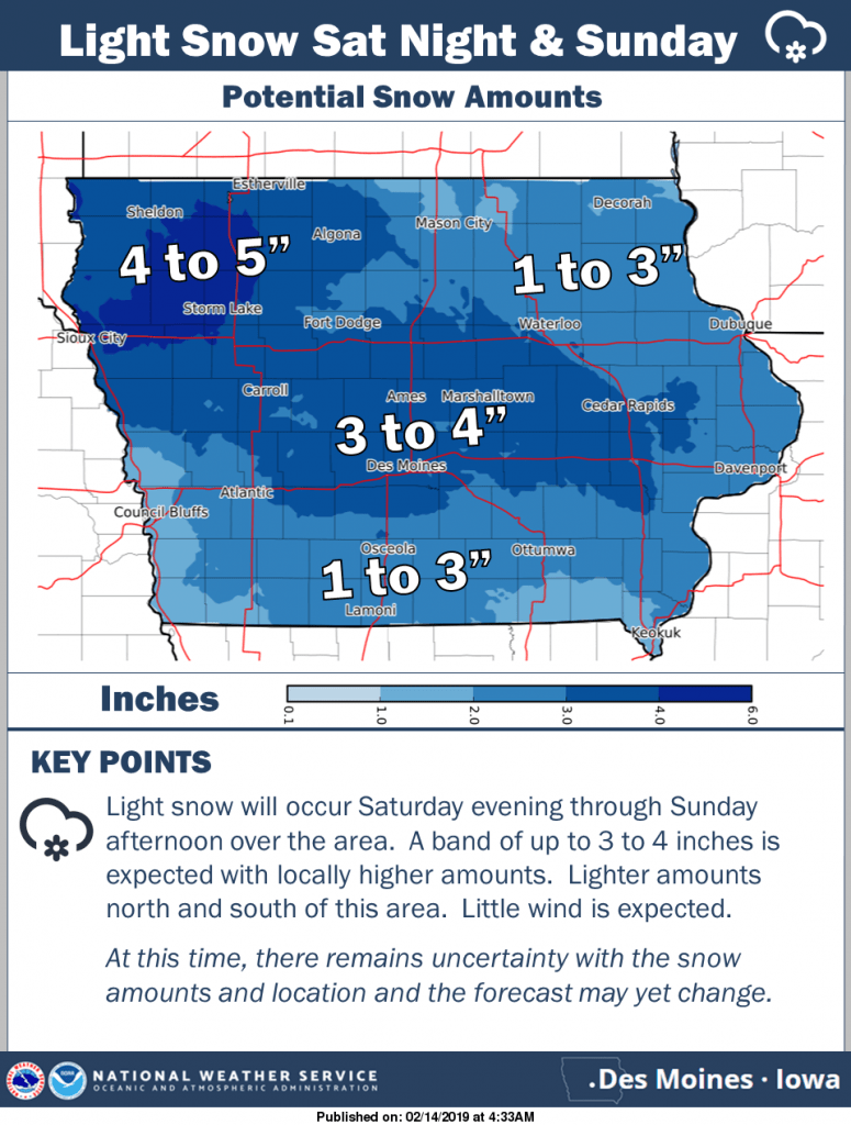
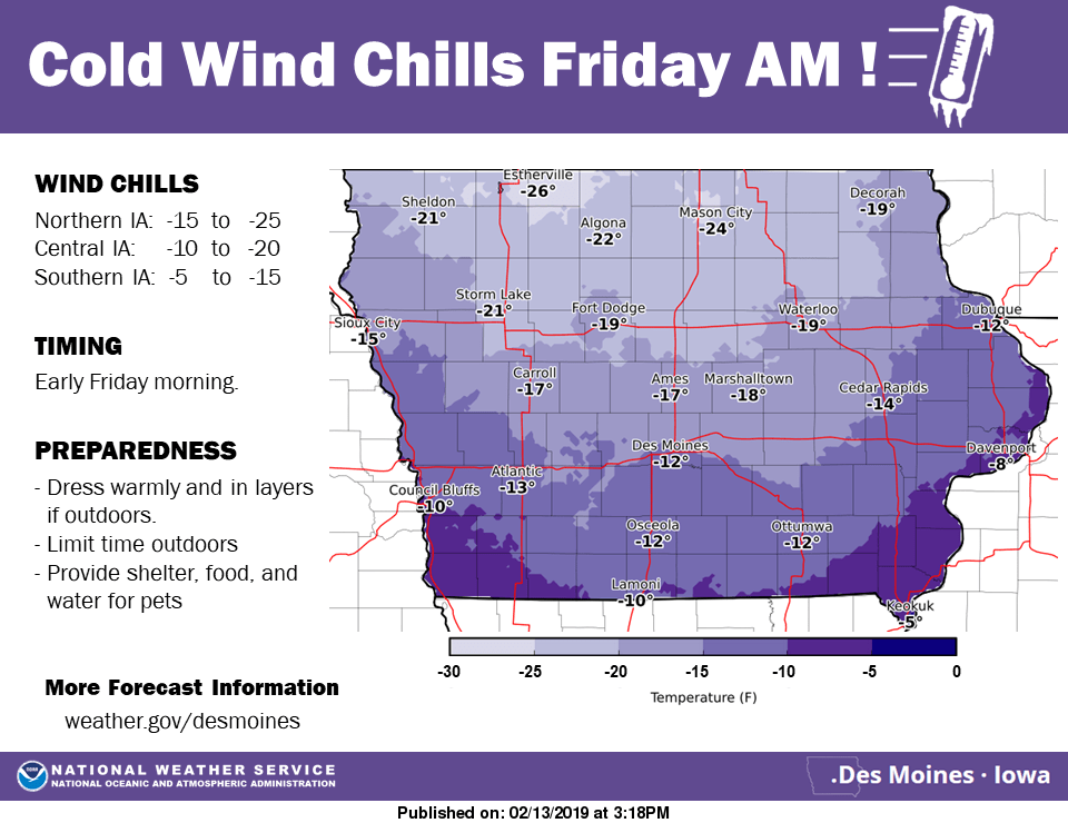
According to the National Weather Service, wind chill values Friday morning will dip to as low as 20 below zero as another cold front impacts the region. Chances for light to moderate snow increase again this weekend, primarily overnight Saturday into Sunday morning.
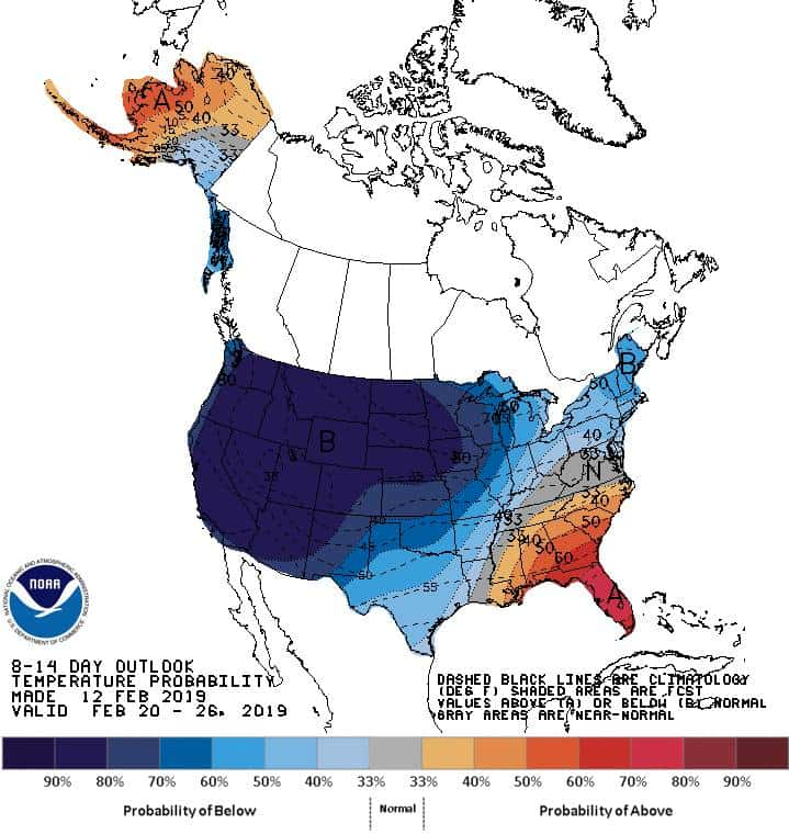
Long term forecast projections by the National Climate Center indicate it could be a while before a significant break comes, as they predicted the final week of the month will be much colder than average, with a heightened chance of precipitation as well. However, initial long-term forecasts for next week call for near-normal temperatures and little to no precipitation.
Stay tuned to 92.1 KRLS for the latest winter weather information.