
Another round of moderate snow is expected to impact the region.
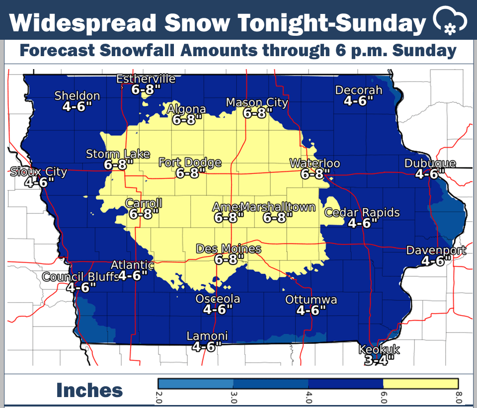
Widespread accumulations of 3-5” are expected in the forecast through Sunday afternoon for a system moving in this evening. A Winter Weather Advisory is in effect from 6 p.m. today to 6 p.m. Sunday. Higher amounts are possible, depending on the track of heavy bands of snow.
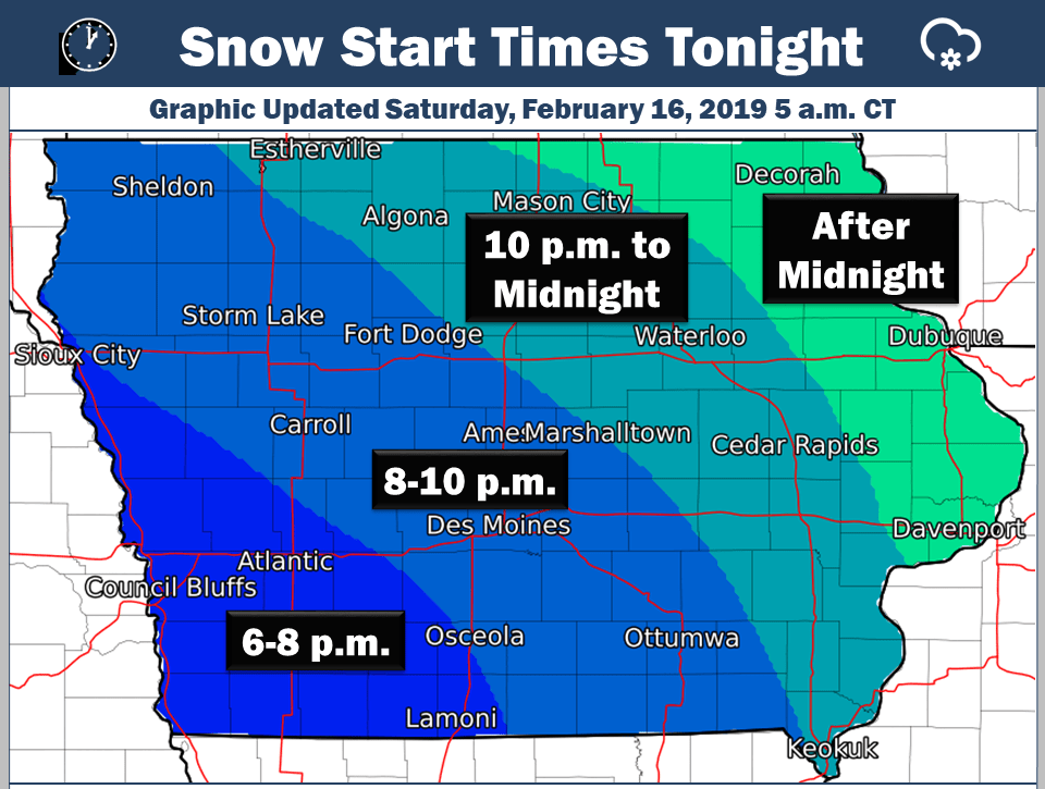
Snow will start in the southwest corner of the state and spread northeast through the overnight. The heaviest amounts will likely fall early Sunday.
It continues a busy winter in the region, as according to the National Weather Service, Marion County has seen close to 3-4 feet of snow so far this season, with the heaviest amounts south of Highway 92. And in a year-to-date summary, since last July, Knoxville has measured approximately 41 inches of snow.
Stay tuned to 92.1 KRLS for the latest winter weather information.