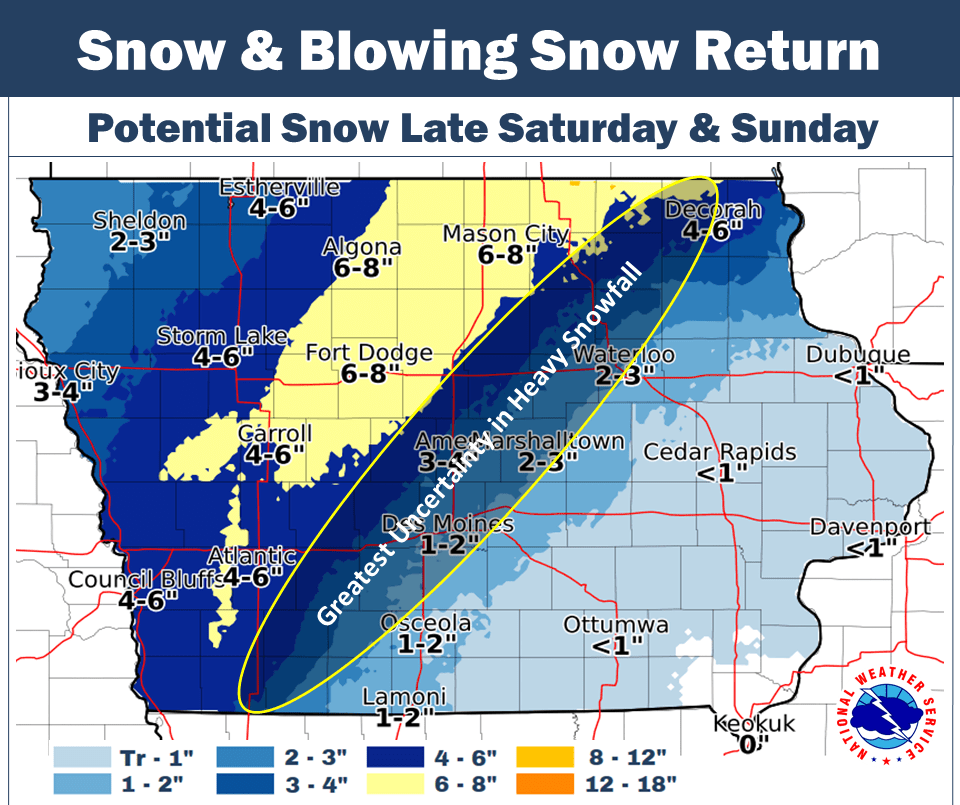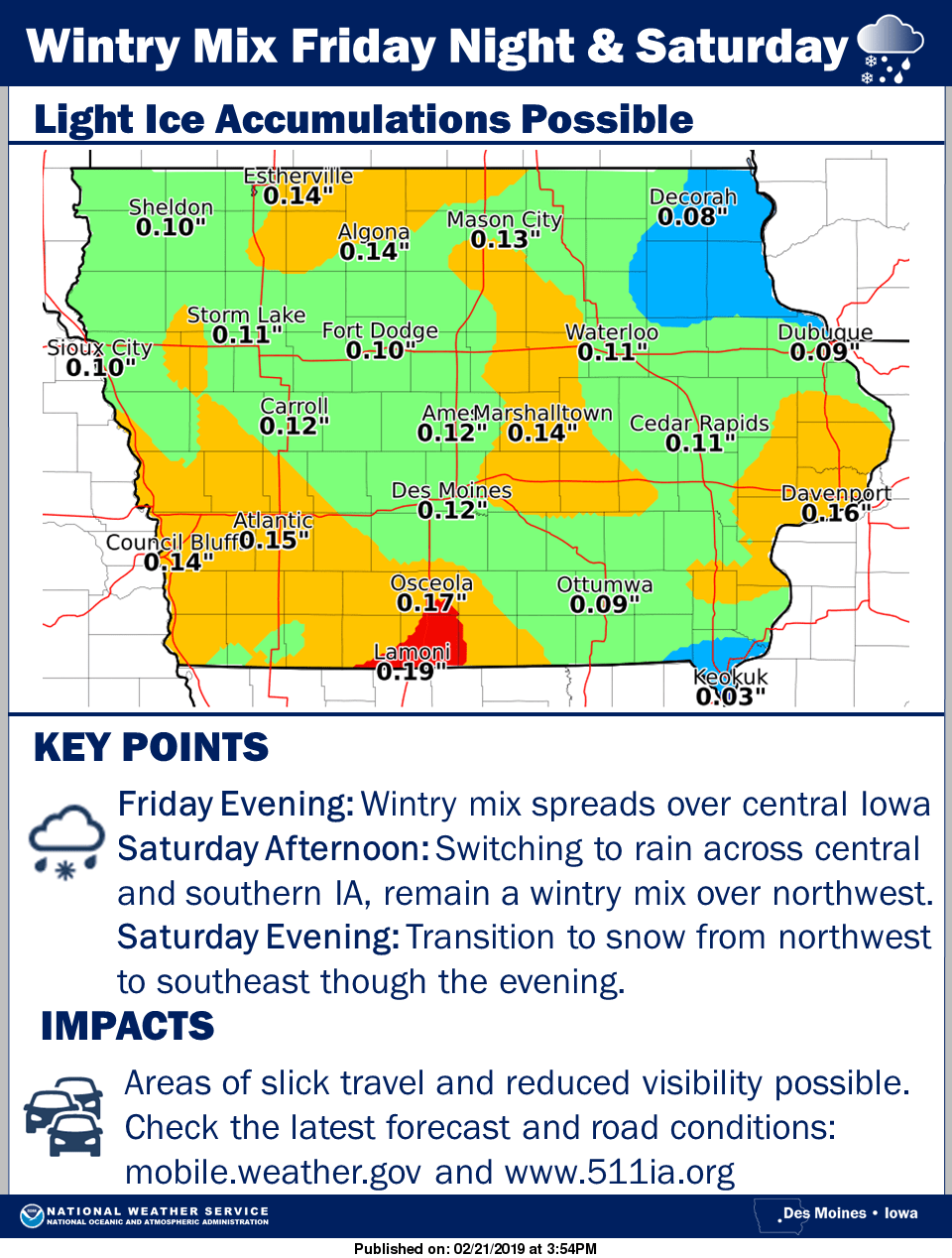
While this week’s predicted winter storm fizzled out for much of the region, another round of rain, ice, and snow may be starting tonight and continuing through Saturday. According to the National Weather Service, heavy precipitation is possible throughout the day, starting as freezing drizzle this evening, transitioning to rain Saturday morning, and then switching to freezing rain, sleet, and snow in the evening. Ice accumulations during the day of up to .15” could be followed by potentially moderate to even heavy amounts of snow overnight through Sunday morning, all depending on when the temperature drops below freezing.
Meteorologists with the National Weather Service say the actual snow amounts will be hard to predict, because of how difficult it is now to narrow down when the temperature could shift. Up to an inch of rain is possible. Travel is expected to be hazardous as gusty winds up to 45 MPH are likely, especially after the transition to freezing precipitation Saturday night. Flooding is also a concern, as rounds of heavy rainfall will accelerate melting of snowpack ongoing since Wednesday afternoon.
A break in precipitation may finally be coming to the area next week starting Sunday, but colder air is also looming, with highs in the teens and twenties expected during the daytime hours, but overnight lows dipping to the single digits and possibly lower by the end of next week. Stay tuned to 92.1 KRLS for the latest winter weather information.


