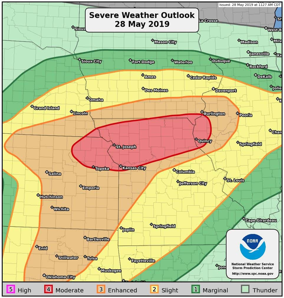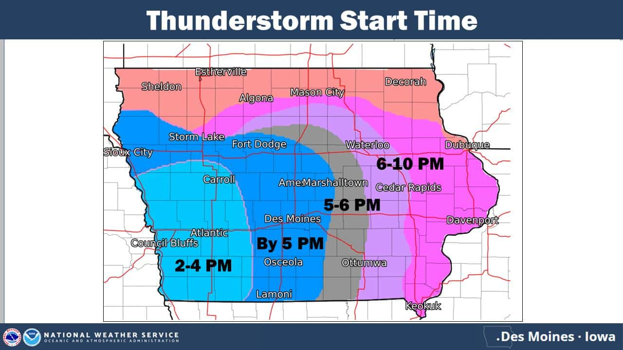
A widespread severe weather event is brewing in south central Iowa today, as an enhanced risk has been issued for most of the area. As determined by the National Weather Service Storm Prediction Center, an enhanced risk means thunderstorms are capable of producing hail larger than an inch in diameter and winds in excess of 60 miles per hour, and could impact a large geographical area. Storms are expected to fire up sometime late this afternoon into the early evening, and could potentially continue until midnight, with multiple warnings possible over the course of the evening.
A flash flood watch is also in effect for the area, as an additional 1-2″ of rain is possible, with higher amounts depending on the track of intense thunderstorms. Most of the region has seen between 5-8 inches of rain since the middle of the month. The KNIA/KRLS Severe Weather Action Team is on the air for any severe thunderstorm or tornado warning for any portion of Marion and Warren Counties. Backup generators ensure coverage stays on KNIA/KRLS if the power goes out.
Earlier this morning, live coverage was prompted for a warning in northwestern Warren County. Staff contributed on the air from from 7:10 to 7:25. Weatherology Meteorologists were providing updates as well.
Rainfall today (since midnight, as of noon)
Knoxville (KNIA/KRLS) – .68″ (2.04” since Saturday; 7.44 since May 1st)
Pella (KNIA/KRLS) – .92″ (2.24 since Saturday; 8.02″ since May 1st)
Middle River near Indianola – .67″ (1.44″ since Saturday; 8.04 since May 16th)
Lake Red Rock – 1.02″ (2.48″ since Saturday, 6.87 since May 16th)
English Creek near Knoxville – .58″ (2.47 since Saturday; 7.72 since May 16th)
Whitebreast Creek near Melcher-Dallas – .79″ (2.1″ since Saturday; 7.09 since May 16th)
Cedar Creek near Bussey – .33″ (1.2″ since Saturday; 5.68 since May 16th)
Des Moines River near Swan – .82″ (2.37 since Saturday; 7.01 since May 18th)
South River near Ackworth – .73″ (1.72 since Saturday; 8.08 since May 16th)


