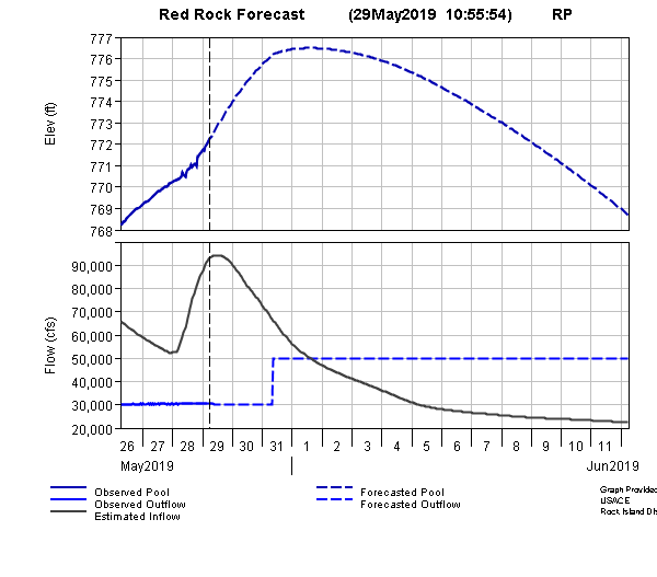
The waters at Lake Red Rock are on the rise, and approaching all-time highs. A forecast crest of 776 feet above sea level, expected in early June, would be one of the top ten highest levels recorded at the dam in its 50 years of existence. Assistant Operations Manager Perry Thostenson says the Army Corps of Engineers will release water at 50,000 cubic feet per second beginning Friday. He says the move has closed campgrounds downstream at Howell Station and Ivans, and will generally have impacts on low lying areas ahead on the Des Moines River. Several inches of precipitation has fallen in the southern half of Iowa since mid-May, along the Des Moines River basin both upstream and downstream from the dam. Between 8 to 10 inches of rain has fallen in most of south central Iowa since May 16th.
Marion County Emergency Management reports that 50,000 CFS outflow will keep the river within its banks in Marion County, except for some minor farm field flooding near the Mahaska County line. Increasing the outflow on Friday will prevent the lake elevation from reaching 777, as previously forecast this morning. The agency says for perspective, in 2010 the river experienced an outflow of 53,000 CFS and had few if any issues.
Hear more about the latest relating to area flooding and Lake Red Rock on Thursday’s Let’s Talk Pella.

