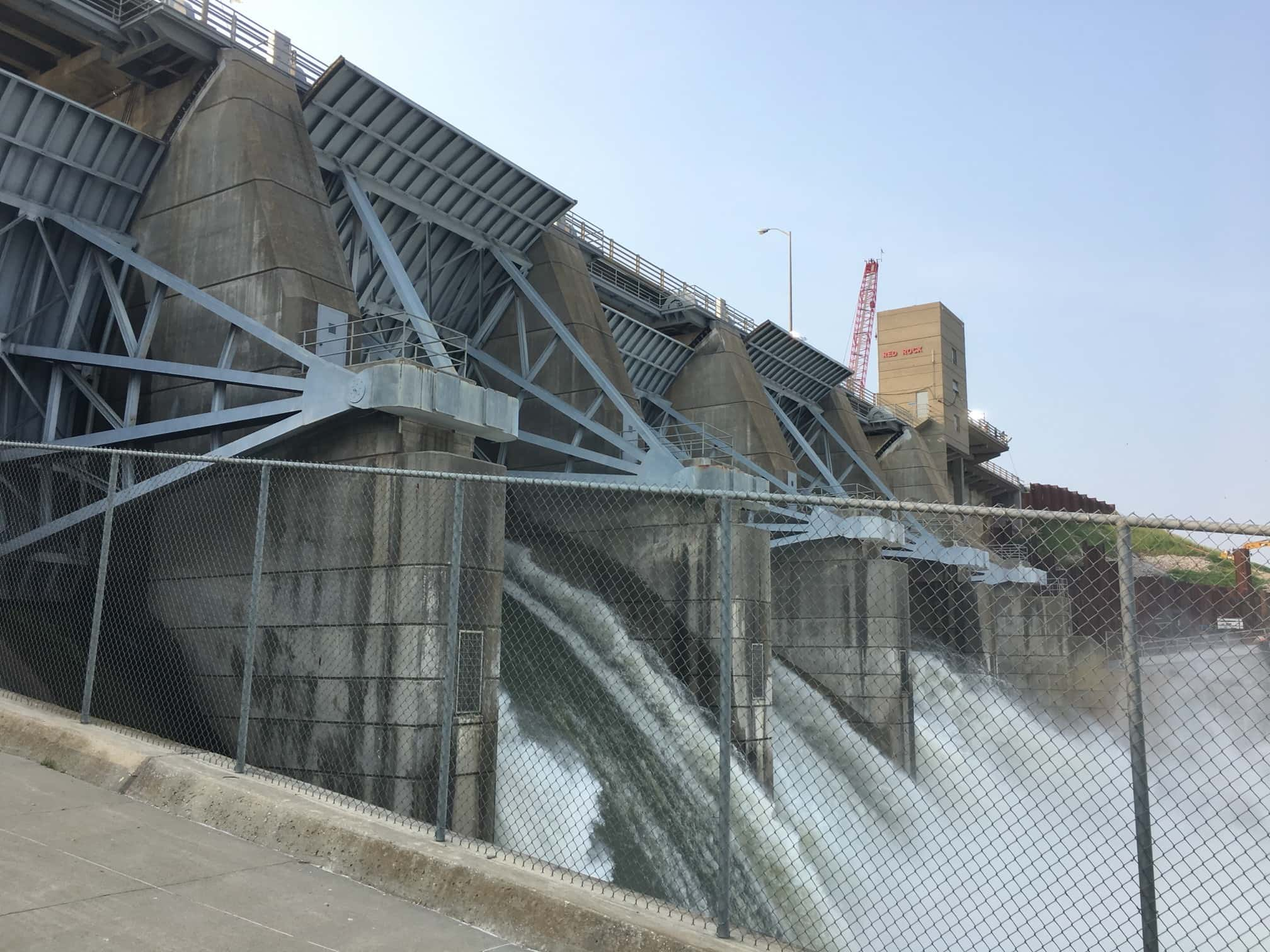
Photo by the U.S. Army Corps of Engineers
The roar of the Des Moines river could be heard loud and clear at South Overlook Friday. The U.S. Army Corps of Engineers have bumped up outflows of the Red Rock dam to 50,000 cubic feet per second, as the lake hit a crest of 775.13 feet above sea level, which makes 2019 one of only eight years to see the dam reach that mark. The amount of water puts the lake 33 feet above normal conservation pool, or approximately 79 percent of flood storage. Assistant Operations Manager Perry Thostensen says the move was made to conserve additional flood storage upstream, and the U.S. Army Corps of Engineers determined there will be minor impacts downstream as a result. On Friday morning, members of the Army Corps of Engineers released water to clear several large tree branches and other debris swept down the Des Moines river during a round of significant flooding and heavy rainfall. According to their latest forecast, outflows will slope downward as water levels decrease upstream.
The Corps of Engineers campgrounds located below the Red Rock Dam, including Howell Station and Ivans, remain closed to the public. It has yet to be determined when Howell Station and Ivans Campgrounds will be able to be reopened. Corps of Engineers campgrounds on the upstream/lake side of the dam are still accepting camping reservations – contact Recreation One Stop online at www.recreation.gov or by calling toll free 877-444-6777.
The South Tailwater Recreation Area and Howell Station Landing will remain open at this time. Boat ramps that are currently usable for lake access include those at the Whitebreast Recreation Area, Marina Cove and Elk Rock State Park (just off of Highway 14). Please note that parking areas at the Marina Cove ramp are very limited during times of high water. All other boat ramps on the lake are closed due to high water levels. The North Tailwater Recreation Area continues to be closed due to construction on the hydropower project.
Boaters: A line of buoys has been placed on the lake approximately a half-mile west of the dam. No boats will be allowed beyond the buoy line for safety reasons. This restricted zone includes the lake area around the North Overlook Beach
Historic Crests
(1) 782.67 ft on 07/13/1993
(2) 779.61 ft on 06/25/1984
(3) 779.32 ft on 06/21/1991
(4) 779.10 ft on 06/14/2008
(5) 778.81 ft on 07/05/2010
(6) 777.95 ft on 05/14/1973
(7) 777.72 ft on 05/18/1993
(8) 775.84 ft on 06/29/2011
(9) 774.00 ft on 05/29/1983
(10) 769.96 ft on 07/02/2015

