
Photo from the National Weather Service
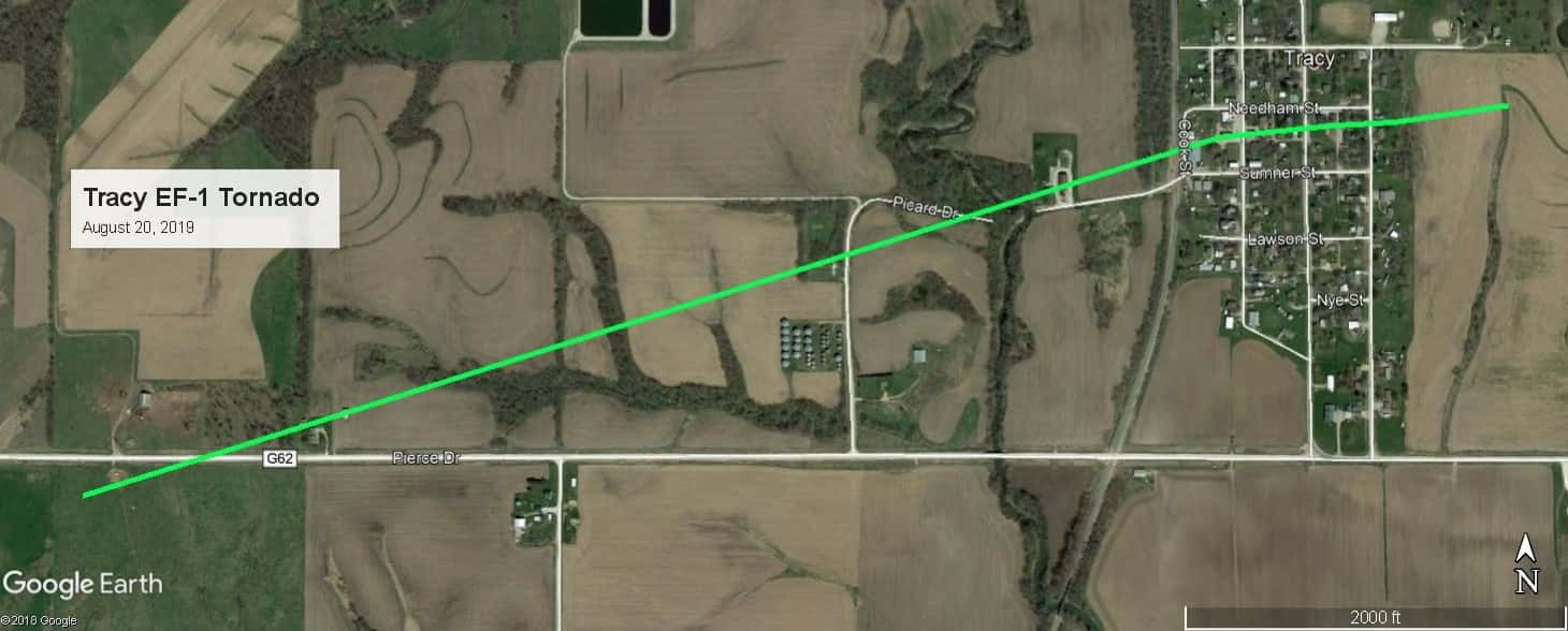
The National Weather Service has conducted a storm survey, and the initial report confirms a tornado hit Tracy this morning. An EF-1 rated storm touched down approximately 1.5 miles west of the community and tracked that far (see above). The top winds were at 110 miles per hour for the storm that was on the ground from 6:21 to 6:23 a.m. No injuries were reported, however, widespread damage to buildings and trees occured. Tracy was under a Severe Thunderstorm Warning at the time of impact, but no tornado warning was issued, as the tornado happened when was mostly dark outside and hard to detect, and may have been rain-wrapped. The tornado in Tracy is the first confirmed in Marion County since a large EF-3 tornado hit Vermeer Corporation in July of last year. Earlier today, Warren County Emergency Management confirmed a tornado impacted the Lacona area in southeast Warren County, which may have crossed the Marion-Warren county line near Melcher-Dallas. KNIA/KRLS was on the air with live Severe Weather Action Team coverage from 5:15 to 7 a.m.
Straight line winds may have been the cause of damage near the Melcher-Dallas area, according to Marion County Emergency Management Coordinator Jeff Anderson.
Photos of damage: