
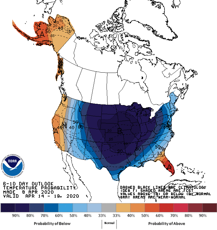
Long-term Forecast from Climate Prediction Center shows high probability of below average temperatures through mid-April
After near-record warmth earlier this week, a much colder trend will take a foothold in south central Iowa. State Climatologist Justin Glisan says a cooler-than-average trend will settle in, starting tonight.
“Friday into next week, we’re going to see a pretty substantial cooldown, and that’s what we are seeing in our short-term outlooks,” he says. “If we look 6-to-10 and 8-14 day outlooks, we’re showing high probabilities of cooler-than-average conditions.”
“During the daytime, we aren’t going to have temperatures below freezing, but at night, for a few days, we are going to have some below average temperatures.”
A hard freeze is expected Thursday evening, and after a brief warmup into the 40s and 50s with plenty of rain in the forecast this weekend, much cooler than average weather is in the long term trend, with daytime highs in the mid 40s and overnight lows near or below freezing expected all next week. Stay tuned to KNIA/KRLS for the latest winter weather information.