
With a burst of cold air greeting residents to start this week, it feels more like late winter than the middle of spring — but that trend will change, and long-term, warmer air will return.
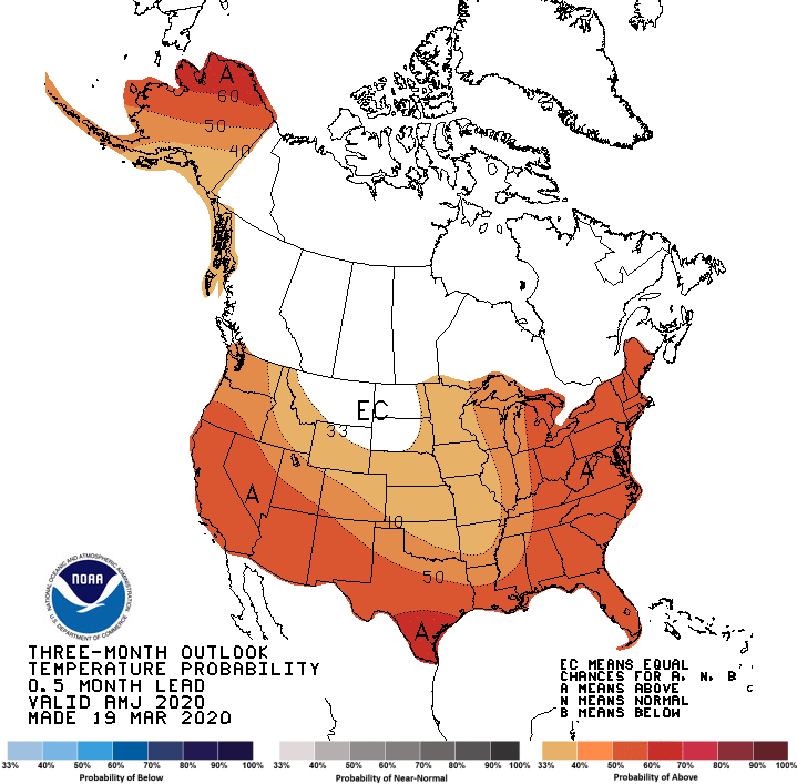
State Climatologist Justin Glisan says while it will be well below normal during this cold snap, the overall trend for April is warmer than average, meaning a strong rebound could be coming.
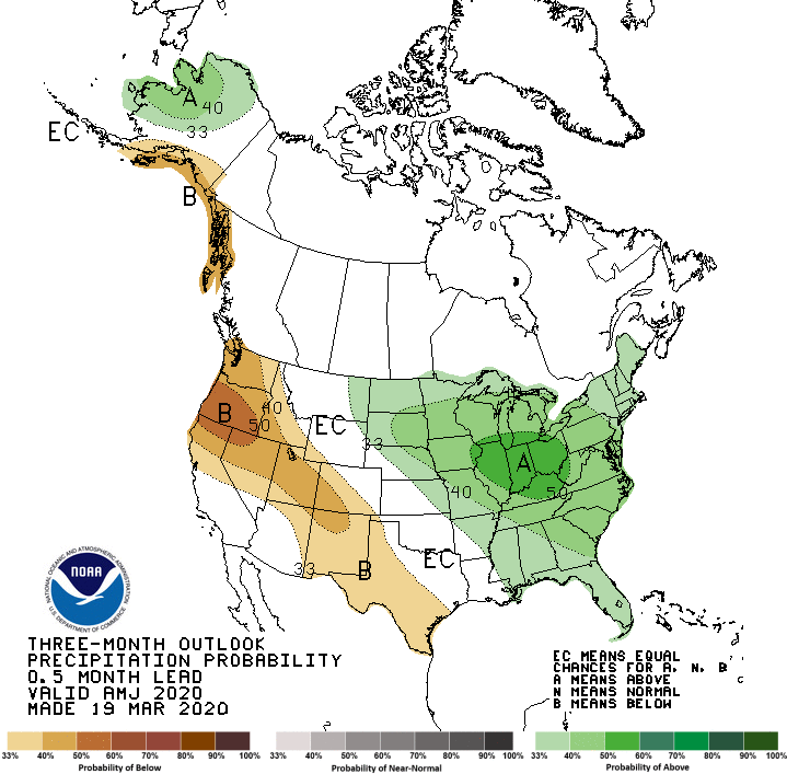
He says above average precipitation continues to be the trend for the rest of the season overall after a string of several wet months, and with it, comes an elevated risk of flooding, especially along the Mississippi River in eastern Iowa, although likely not as devastating as 2019.
Daytime temperatures will stay well below normal and overnight lows below 30 through Friday morning, with significant bounce back into the upper 50s and low 60s by the weekend.