
UPDATED POST: https://www.kniakrls.com/2020/04/15/winter-weather-advisory-issued-for-more-april-snow/
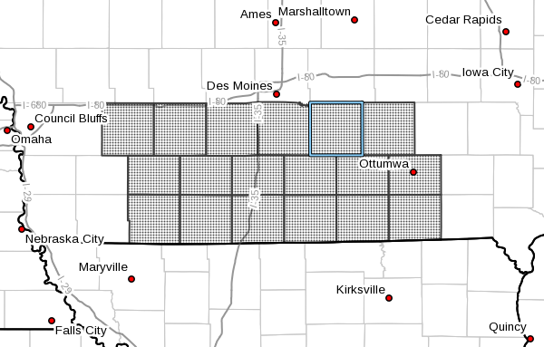
A burst of moderate to heavy snow is expected over most of southern Iowa Thursday. A Winter Storm Watch has been issued from Thursday at 5:00 AM to Friday at 7:00 AM.
Widespread snow is expected mainly beginning in the afternoon and will likely continue through early Friday morning, with the heaviest accumulations expected during that time. Visibility will be significantly reduced and roads may become slick as temperatures drop below freezing late in the evening Thursday.
Current forecasts from the National Weather Service indicate between 2-4″ of snow in Marion and Warren Counties, with heavier amounts up to nine inches possible mainly along and south of Highway 34 to the Iowa-Missouri Border.
This system comes after 1-4 inches of snow accumulated late Tuesday night into early Wednesday morning, all of which has melted.
Stay tuned to KNIA/KRLS for the latest weather information.