
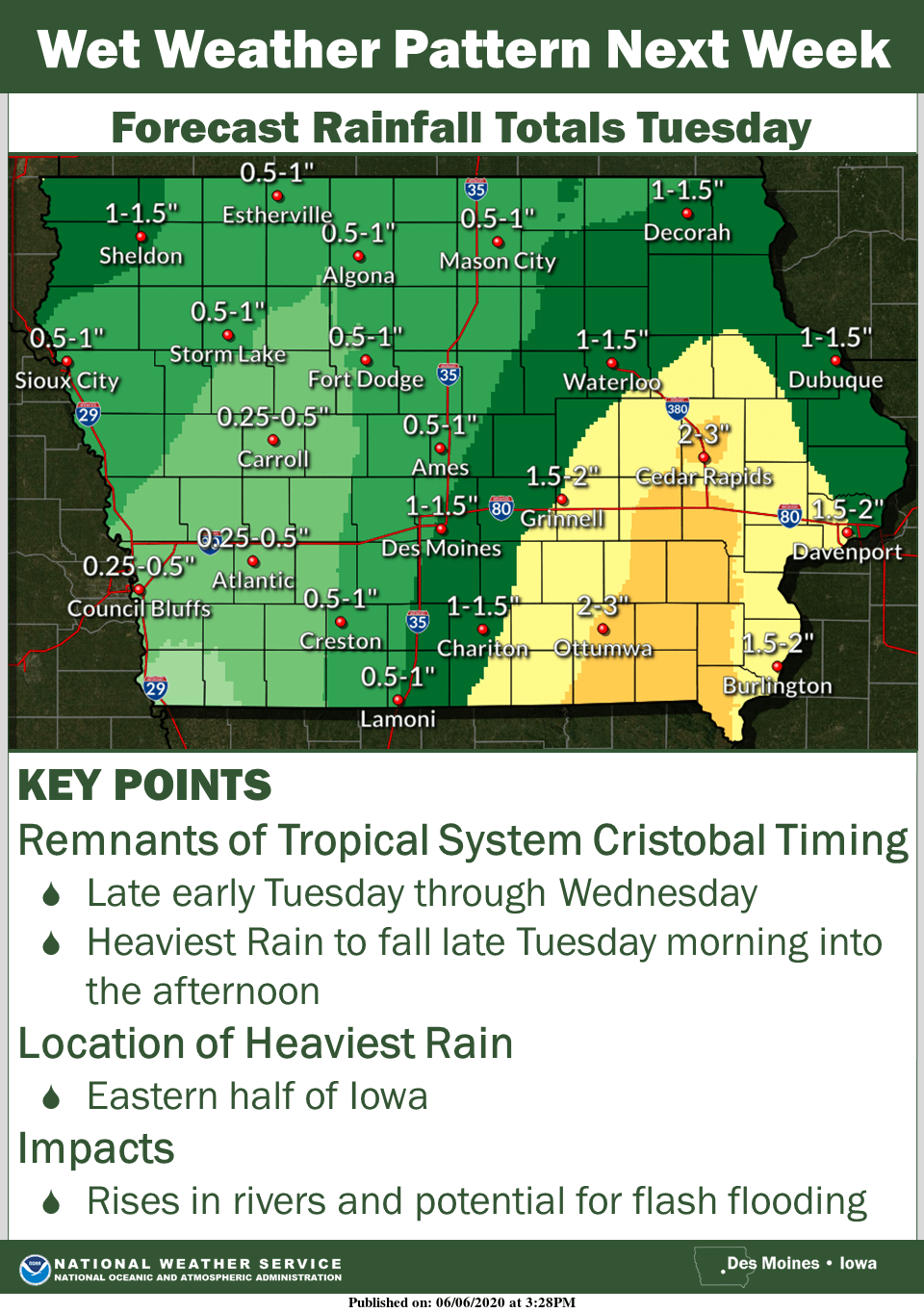
After another round of unseasonable heat early in the week, heavy rain is possible across south central Iowa, especially in the eastern half of the state.
According to the National Weather Service, the remnants of Tropical System Cristobal are forecast to push north late Monday and linger into Wednesday evening. The threat for moderate to heavy rain exists over the eastern half of Iowa Tuesday into early Wednesday with the heaviest rain likely to fall late Tuesday morning through the early evening, which includes Marion and Warren Counties. Forecast rainfall totals may shift a bit in the next day, but confidence is increasing of the potential for rising rivers and flash flooding across eastern parts of the state. Most areas are expected to receive between 1-2” of rain, with more possible depending on the development of additional storms and the exact track of tropical moisture. Significantly cooler air will follow the rain Wednesday, with highs in the mid to upper 70s expected through the end of next weekend.
Stay tuned to KNIA/KRLS for the latest weather information.