
A burst of mild air will settle into the region as the calendar turns to August.
State Climatologist Justin Glisan says in the short-term, cooler-than-average air and a near normal to wetter trend is in place over the next 7-14 days.
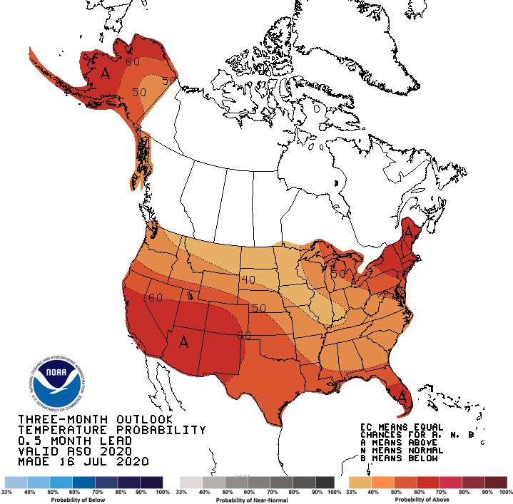
Glisan says when it comes to predicting the long-term climate over the next three months (See map above), it appears that warmer-than-average trends are coming up, which will be an improvement over the past few harvest seasons. Equal chances for above and below normal precipitation remain, as the climate predictions have been harder to track, according to Glisan, due to what’s called “ENSO Normal” conditions in the Pacific.
According to the National Weather Service daytime highs will drop to the upper 70s by Sunday, and stay near 80 degrees through late next week.