

Widespread damage was reported throughout south central Iowa after a large wind storm moved through the region late Monday morning.
—
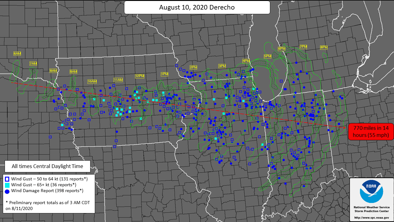
FROM NWS: An intense derecho moved from far southeast South Dakota into Ohio yesterday (8/10/20). This derecho traveled approximately 770 miles in 14 hours and produced widespread damaging wind gusts, including numerous wind gusts over 74 mph (65 kt) & several over 90 mph in central Iowa.
—
Wind gusts between 60 to 90 miles per hour slammed the communities of Pella and Knoxville, and the majority of Marion and Warren Counties. Extensive damage to buildings and trees was reported in both Pella and Knoxville, and power outages and other damage was reported throughout the county, including in Columbia. The community of Cumming in Warren County also had several trees reportedly knocked down.
The KNIA/KRLS Severe Weather Action Team was on the air from 10:40 a.m. to 12:30 p.m., with reports in the field from reporters in Pella, Indianola, Knoxville, Pleasantville, and Monroe, as well as live updates from Weatherology and 10 staff members contributing to coverage. Backup generators kicked on due to power outages, and coverage remained on the air.
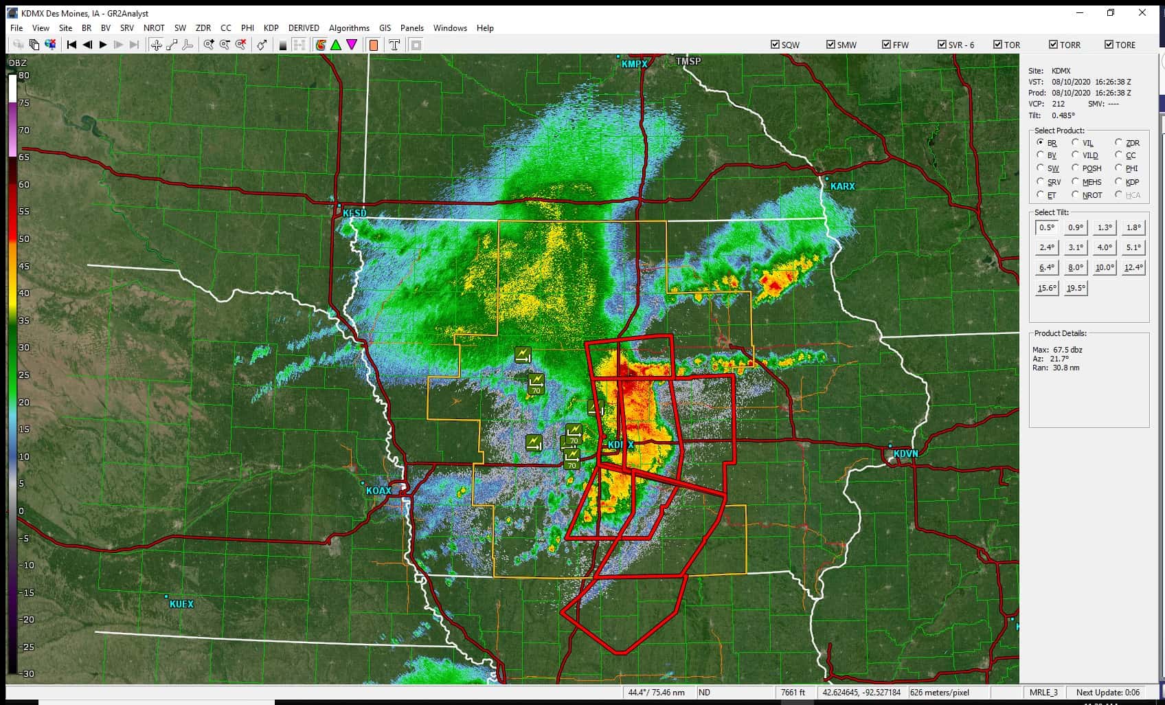
National Service Weather Radar during event Monday:
The storm has been officially classified as a derecho, which is a 250+ mile swath of wind damage, including gusts of at least 58 mph along most of its length, and several, well-separated 75 mph or greater gusts. A wind gust of 85 miles per hour was reported near Prairie City, and a gust of 75 MPH was recorded in Leighton, 71 MPH at the Knoxville Airport, and 58 MPH in Indianola.