
After a stretch of above average warmth to start December, winter weather conditions return to south central Iowa to end the week.
Daytime highs Wednesday came within one degree of breaking a previous Marion County record high of 60 set in 1979, and similar conditions will be in place today throughout the area.
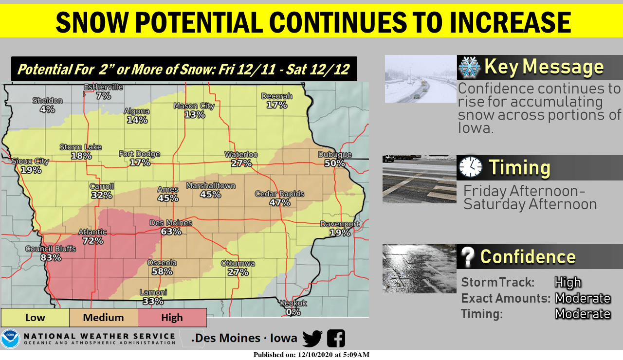
However, a cool down comes Friday–and with it, the potential for widespread light to moderate snowfall. According to the National Weather Service, confidence has been increasing for precipitation starting Friday afternoon and continuing through Saturday morning in central Iowa. Initial forecasts indicate 1-3″ of snow could fall during that time, with higher amounts possible depending on the track of colder air and moisture lifting from the southwest. Following the snow, daytime highs in the low-to-mid 30s are in the long-term forecast.
Meteorologist Jeff Zogg reminds all residents to be prepared for winter driving conditions, with snow potentially bringing out Iowa DOT and local plows.
Stay tuned to KNIA/KRLS for the latest winter weather information.