
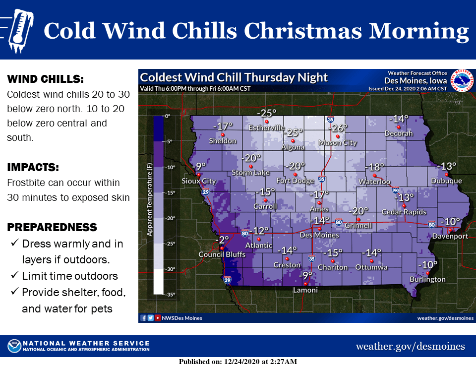
Wind chill values will drop below zero through Christmas Morning. Northwest winds of 10 to 15 mph, will combine with bitter air to produce wind chills from 10 to 20 below zero in south central Iowa. The National Weather Service reminds everyone to dress warmly and in layers if spending time outdoors, and try to limit exposure time, and to provide warm shelter, food and water for any outdoor pets. Daytime highs will bounce back somewhat quickly, with highs in the mid 30s by this weekend.
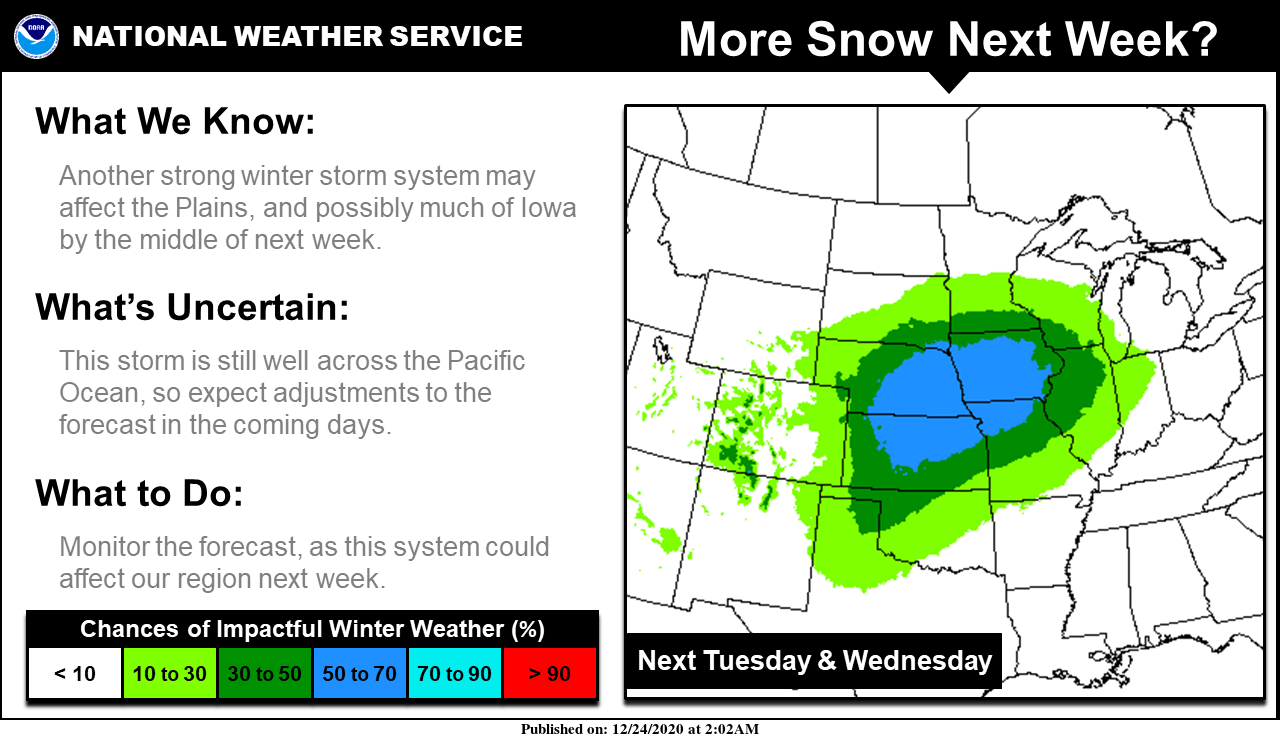
There is another potential storm to keep an eye on for next week, possibly on Tuesday and Wednesday. The system in question is still quite a ways away–well across the Pacific, but the National Weather Service is monitoring the situation. Forecast changes are likely, but for the time being there is a greater that 50% chance of impactful winter weather in parts of Iowa, Nebraska, Kansas, and Missouri. Those with holiday travel plans should continue to watch the latest forecasts in the coming days.