
Another round of winter weather impacted the region over the weekend, with a mix of rain turning to snow overnight Saturday into Sunday morning.
In total, most areas received between a trace to three inches of snow, with 2 ¾” in Pella and 2 ½” in Knoxville and lower amounts further west. Additionally, between a trace to ½” of rain fell prior to the change to freezing precipitation.
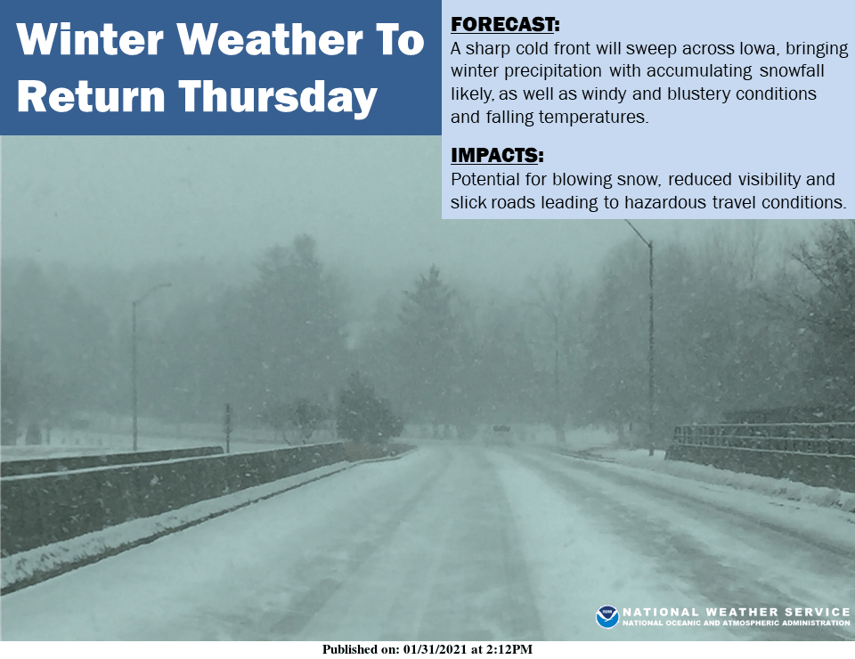
The start to the week will remain dry and mild, according to the National Weather Service, with highs peaking into the upper 30s and low 40s on Wednesday. A strong cold front is expected to pass through the state on Thursday, with mixed precipitation turning into snow during the early afternoon, with strong winds possibly making travel hazardous Thursday evening.
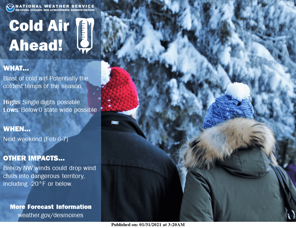
Dangerous, arctic cold is possible for the first time this winter, with highs dipping into the single digits this coming weekend with wind chills well below zero expected.