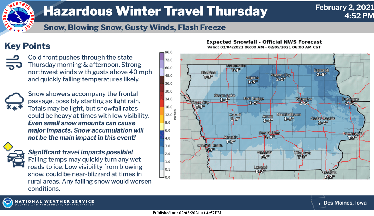
A strong cold front will cause headaches for many Thursday across the state and in south central Iowa.
According to the National Weather Service, rain will start in the morning and by midday, transition to snow. Winds will begin to reach their peak speed by Thursday afternoon, which could “flash freeze” any precipitation received on area roadways, which means ice will quickly form faster than plows can attack it. Accumulations of 1-4” of snow are possible, but even with lower amounts, the National Weather Service reminds all residents to exercise caution as wind will lower visibility and keep pavement and gravel slick.
After Thursday’s travel difficulty, much colder air begins to settle into the region, and another strong front will bring arctic temperatures into play. Wind chills below zero are expected starting this Saturday, and dangerously frigid air will begin Sunday morning and continue through late next week, with values as low as 20 below zero possible during those times–especially in the overnight and morning hours. According to the National Weather Service, the air won’t feel like it’s above zero for up to five days straight. Residents are reminded to avoid time outdoors for extended periods of time, to protect pets from the cold, and to wear plenty of layers.
Stay tuned to 92.1 KRLS for the latest weather information.

