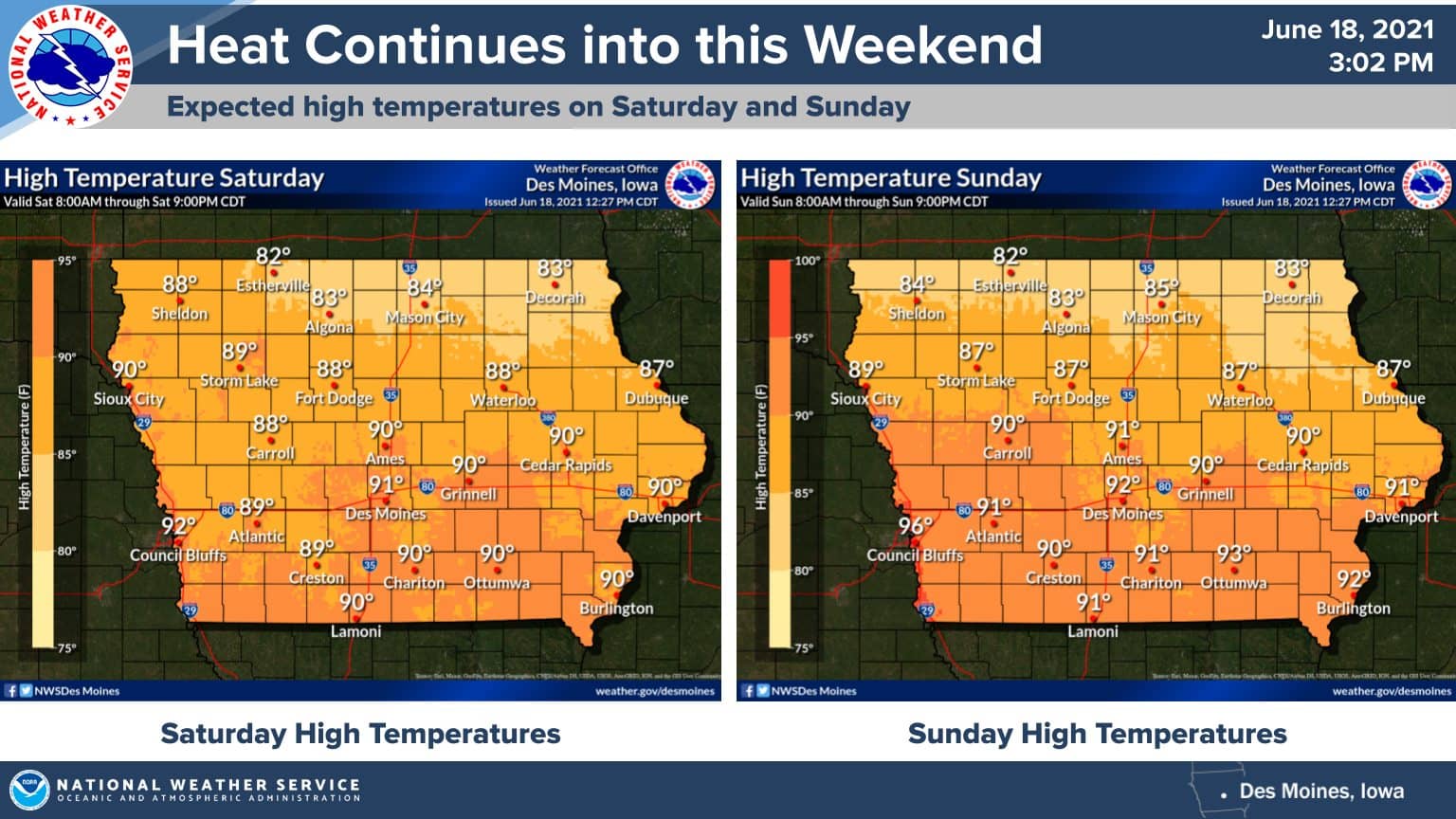
A strong cold front will pass through the region by Monday, bringing additional chances for needed rain and a brief break from the heat across south central Iowa.
According to the National Weather Service, another day of above average heat will kick start the weekend, but two rounds of precipitation are expected — one early Sunday and again in the late afternoon to evening.
A significant cooldown will follow, with daytime highs in the lower 70s Monday, before a bounceback into the upper 70s and low 80s for temperatures by Wednesday afternoon.
Moderate drought conditions remain in place across most of the region, with severe conditions reported near the Des Moines metro and in northwest Warren County. Streamflows along the Raccoon and Des Moines River Basins remain well below average as well.

