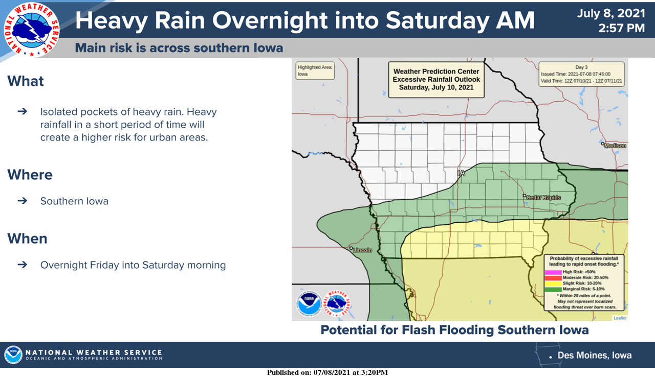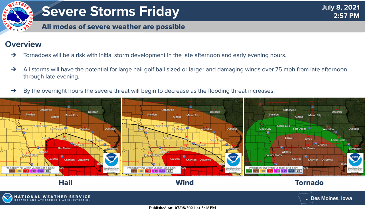
Those with outdoor plans this evening will want to stay weather aware. An enhanced risk of severe weather has been issued by the National Weather Service for most of south central Iowa. Large hail, damaging winds, and isolated tornadoes are all possible in the evening hours. The threat will switch to potential heavy rainfall overnight. Widespread precipitation totals between one to two inches are in the forecast through Saturday evening, with torrential downpours possible that could see localized amounts up to four inches. Thunderstorms earlier in the day may impact the exact locations of severe weather and heavy rain threats. The KNIA/KRLS Severe Weather Action Team is on the air for any severe thunderstorm or tornado warning for any portion of Marion and Warren Counties.