
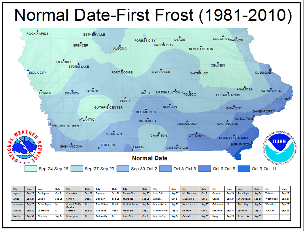
It still may be quite a while until the first round of frost impacts south central Iowa.
According to the National Weather Service, most of the region typically reports the first frost by October 1st — however, a recent stretch of near record warmth kept temperatures well above the threshold of fall-like weather, and while slightly cooler over the next seven days, above average conditions are expected to continue. Typically, air temperatures need to cool to the mid-30s before frost would form on the ground, as the surface is typically a few degrees cooler.
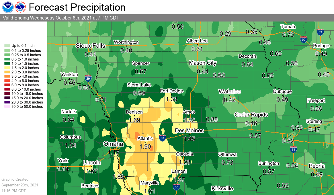
Chances for rain return to the region beginning today, with periodic showers and thunderstorms possible through Sunday afternoon. Any precipitation that occurs over the next several days will be mainly scattered in nature. Many locations are forecast to receive between 1/2″ to an inch of rainfall during that timeframe, although some totals may be heavier if thunderstorm activity occurs.