
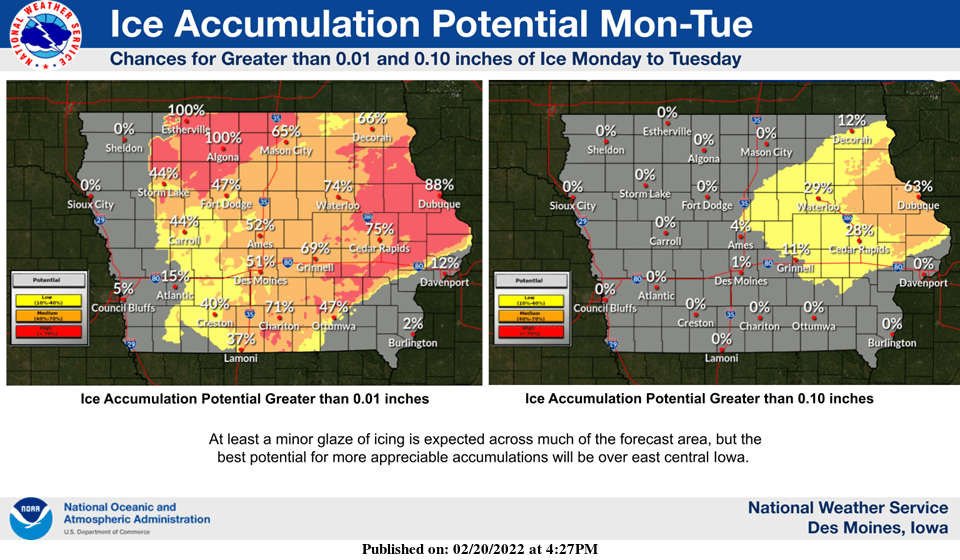
After a blast of spring like air Sunday, winter returns this week. Travel could be hazardous Tuesday morning across most of the state as a wintry mix of precipitation is expected. Freezing rain will primarily impact south central Iowa, with ice accumulations as high as 1/10th of an inch in the forecast by noon Tuesday, according to the National Weather Service. Much colder air will follow, with daytime highs in the 20s and overnight lows in the single digits through the weekend. Another round of light-to-moderate snow is possible Thursday as well. Stay tuned to KNIA/KRLS for the latest winter weather information.