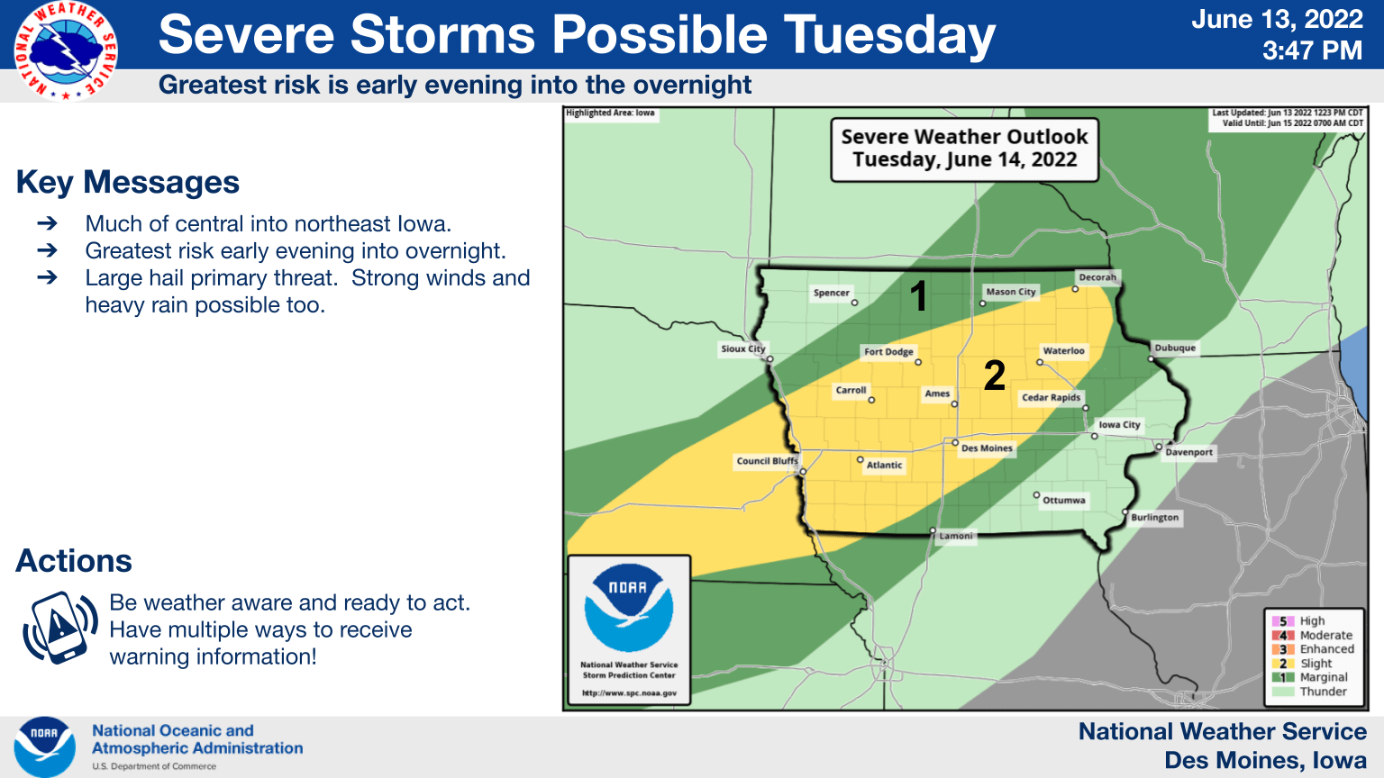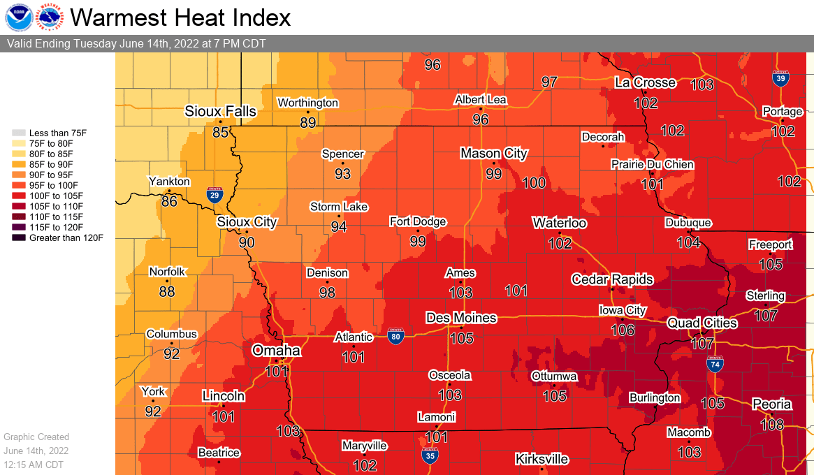
Potentially record-breaking heat continues through Wednesday, according to the National Weather Service. Heat index values will likely top 100 this afternoon and evening with wind gusts up to 30 MPH and high humidity expected. While slightly cooler Wednesday, highs could still approach the mid-90s with similar conditions remaining in place. A few chances for storms will return this evening and again on Wednesday afternoon and evening, with the National Weather Service Storm Prediction Center issuing a slight risk for severe weather today and tomorrow, as scattered thunderstorms are capable of producing large hail and damaging winds. Slightly cooler conditions will return late this week with highs in the upper 80s before another round of oppressive heat is expected to return by Sunday into early next week.