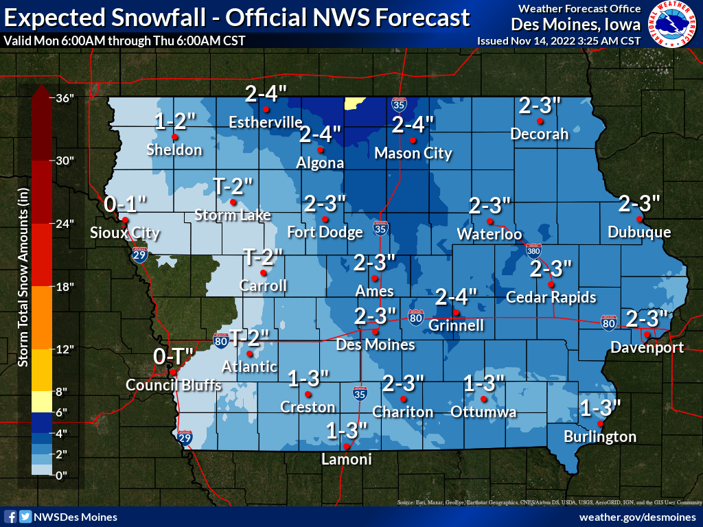
It’s felt a lot like the holiday season and early winter with a burst of cold air that arrived last week across south central Iowa, and the first measurable snow of 2022-23 is possible this week as well.
According to the National Weather Service, light snow is possible starting in the early morning hours Tuesday through early Wednesday. Widespread amounts between one to two inches are possible, although how much sticks to pavement may be much lower than what stays on other surfaces due to daytime heating early this week. Travel may be difficult in some areas throughout the day, depending on the timing of winter precipitation and surface temperature on area highways.
Typically, the first inch of snow of the season doesn’t fall until early December, according to 30-year climate averages from the National Weather Service.
Even colder air is expected later this week as well, with daytime highs plummeting into the 20s by Thursday and continuing through the weekend, with wind chill values approaching and even possibly dropping below zero those mornings.

