
A burst of arctic air and two rounds of snow are expected in the week leading up to Christmas, according to the National Weather Service.
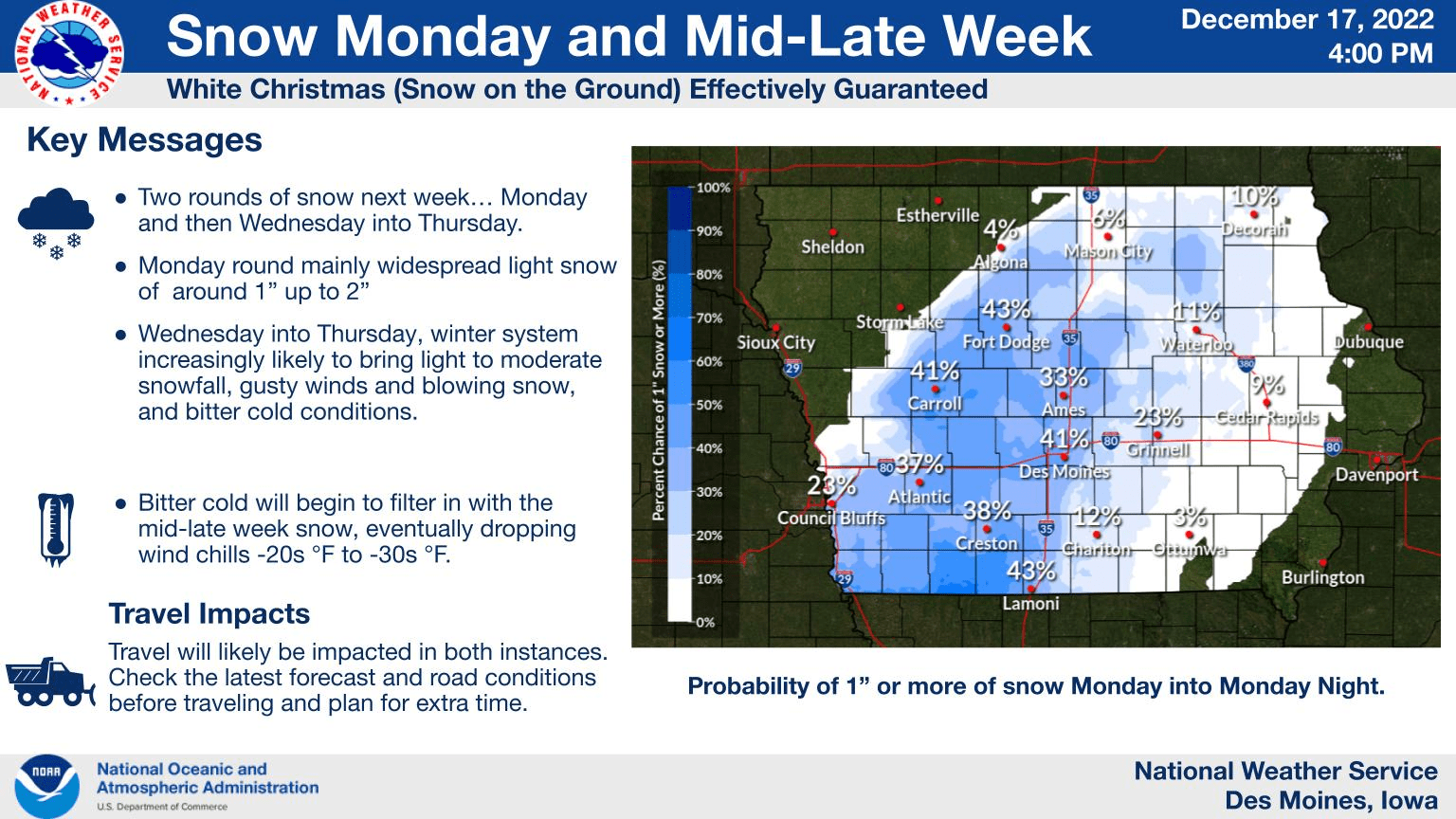
Light snowfall is expected Monday, with widespread amounts between a trace-to-two inches likely by Tuesday morning. Behind that snow will be colder conditions, with highs primarily in the teens and overnight lows dropping into the single digits Tuesday and Wednesday.
Another round of snow is in the forecast starting Wednesday afternoon and continuing through Thursday morning. Gusty winds will be coming along with that storm, causing more travel concerns, especially Thursday morning, and initial forecasts indicate more moderate accumulation is possible, with predictions currently ranging from two-to-four inches.
Extremely cold conditions are expected to end the week, with wind chills ranging from 20 to 30 below zero Friday and Saturday. Frostbite and hypothermia can occur in as little as 30 minutes without proper precautions in those conditions.
Stay tuned to 92.1 KRLS this week for updates regarding road conditions, local cancellations and delays, and the latest Weatherology forecast.