The ongoing winter storm has a unique reason behind it as bitter, arctic cold spreads across the region and the majority of the United States.
State Climatologist Justin Glisan says a “bomb cyclone” formed from a rapidly strengthening low pressure system.
“It’s called bombogenesis, and that tells us that the low pressure system has access to all of the ingredients that it needs — heat, moisture, and air that is rising. So all of those things are coming — we’re getting warmer, moist air from the southeast from the moisture gate to the Gulf of Mexico, and then we have a very cold, arctic air mass moving from Canada and the Arctic moving into the Midwest. Those two things are coming together.
If you think of a figure skater and how a figure skater stretches out and spins faster, that’s what happens when a low pressure system intensifies — it spins faster and it’s able to wrap those ingredients together.”
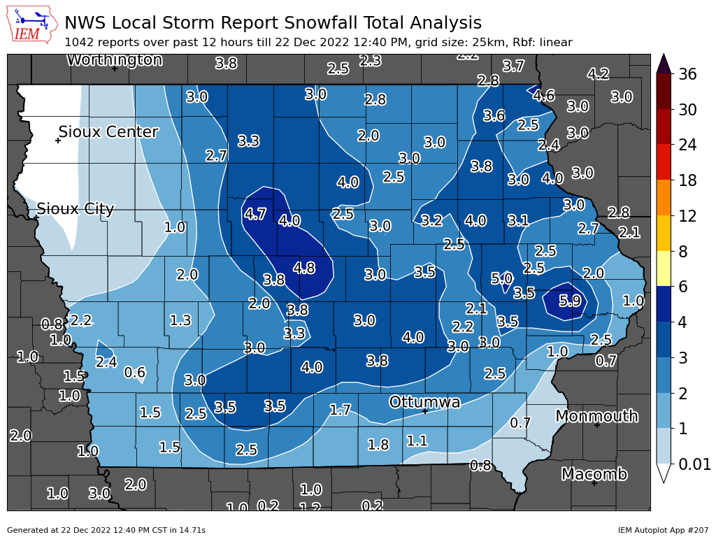
The intense system brought widespread amounts of 3-5” of snow in central Iowa, and winds up to 50 MPH continuing today will still cause major travel concerns, even if a roadway was previously cleared.

