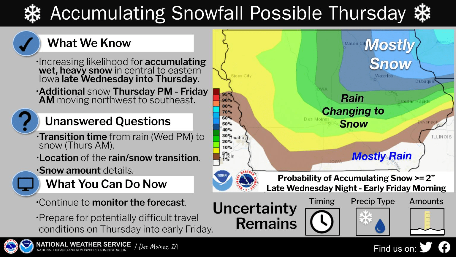
A mix of rain and snow is possible across south central Iowa this evening. According to the National Weather Service, precipitation is expected to begin sometime after sunset and continue through the early morning — and at some point, transition to frozen before it ends. Light snow is also possible later in the day Thursday, and travel may be hazardous, especially in the northeast quarter of Iowa. Precipitation amounts may vary, with approximately 1/2″ of total liquid expected — but snowfall amounts will depend on the transition of colder air. Many roads may remain clear due to recent warm weather as well. A brief cooldown will linger into Friday with highs topping out near 30 and wind chill near zero possible Saturday morning, before bouncing back into the 40s for the long term.

