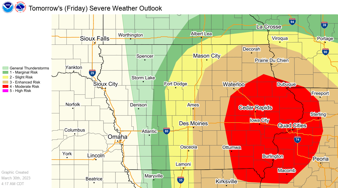
An intense round of severe weather is becoming more likely in the eastern half of Iowa Friday, according to the National Weather Service. Most of south central Iowa is considered in an enhanced risk, while eastern Iowa is in a moderate risk. The National Weather Service Storm Prediction Center often issues different levels of advanced notice to better prepare areas they forecast to have intense storms. An enhanced risk means numerous severe thunderstorms are likely in the area, and in the case of Friday’s system, strong winds in excess of 70 MPH and multiple tornadoes will be the primary threat — that includes Marion and Warren Counties in the map above. For those in the moderate risk area (shaded in red above), that means a severe weather outbreak is likely, and widespread damage is anticipated.
A pool of warmer air today will linger overnight — daytime highs this afternoon will top out in the mid-60s and lows will only dip into the 50s. A powerful cold front is expected to sweep across the state primarily in the afternoon Friday, which is expected to trigger fast-developing and moving storms capable of producing major wind gusts and multiple tornadoes in Iowa. Even after the severe weather threat passes, sustained winds of 20-25 MPH and gusts up to 50 MPH will continue through early Saturday morning. Temperatures will plummet to freezing and wind chills will drop into the teens during that time as well.
The KNIA/KRLS Severe Weather Action Team is on the air with live coverage for any severe thunderstorm or tornado warning for any portion of Marion and Warren Counties.

