
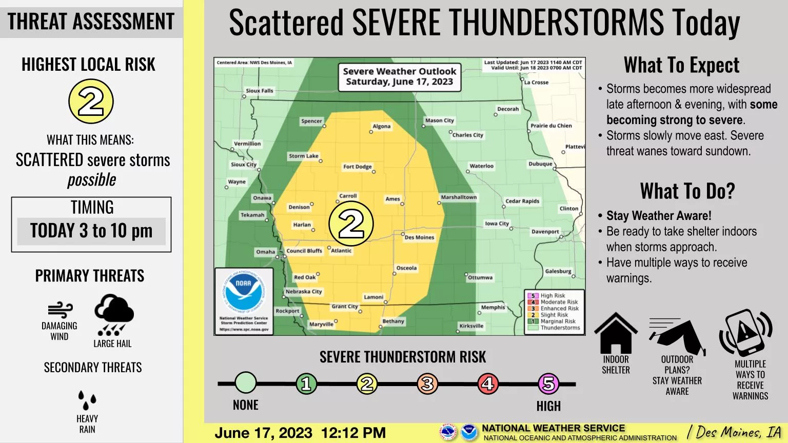
Scattered thunderstorms will move into western Iowa today and spread across the state by tonight. The likeliest time will be from mid-afternoon through this evening, when some of the stronger to severe storms may produce hail and gusty winds. The system is also slow moving, increasing the potential for locally heavy rainfall into tonight. The storms will then diminish overnight before moving out later Sunday, followed by several days of dry and warmer weather with daily highs in the coming work week generally in the upper 80s to lower 90s.