

It’s been 30 years since the majority of Iowa was devastated by record floods, and locally, the Red Rock Dam hit an infamous milestone.
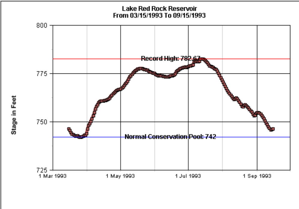
On July 13th, 1993, the Des Moines River at Lake Red Rock topped at its record elevation of 782.67 feet above sea level — 40 feet above what is considered “normal” today. That year, Iowa Homeland Security estimated 15-20″ of rain more than normal had fallen in Marion County and most of the Des Moines River basin, with many locations getting over two feet above normal — the statewide average for precipitation was 48.13 inches. On July 14th, the outflows of the dam were 104,000 cubic feet per second; the current outflow is between 1,000 to 1,500 cubic feet per second.
Video by Steve Carson:
According to data maintained by the U.S. Army Corps of Engineers, on July 12th, 1993, the Des Moines River at Tracy reached its 3rd ever highest mark at 24 feet, 16 inches – flood stage is 14 feet, and that was the also the worst flooding at the point on the river since the Red Rock Dam was constructed in 1969. On that same day, the Des Moines River immediately downstream from the Red Rock Dam was at its highest ever mark at 109.71 feet as well.
This year also marks 15 years since the 2008 floods. Red Rock Reached 779.1 feet — its 4th highest crest of all-time, and also marked another occasion were outflows topped 100,000 feet per cubic second.
Hear memories from Park Ranger Tracy Spry about the 1993 floods — who was working in her second year at the local office then, on today’s Let’s Talk Pella.