
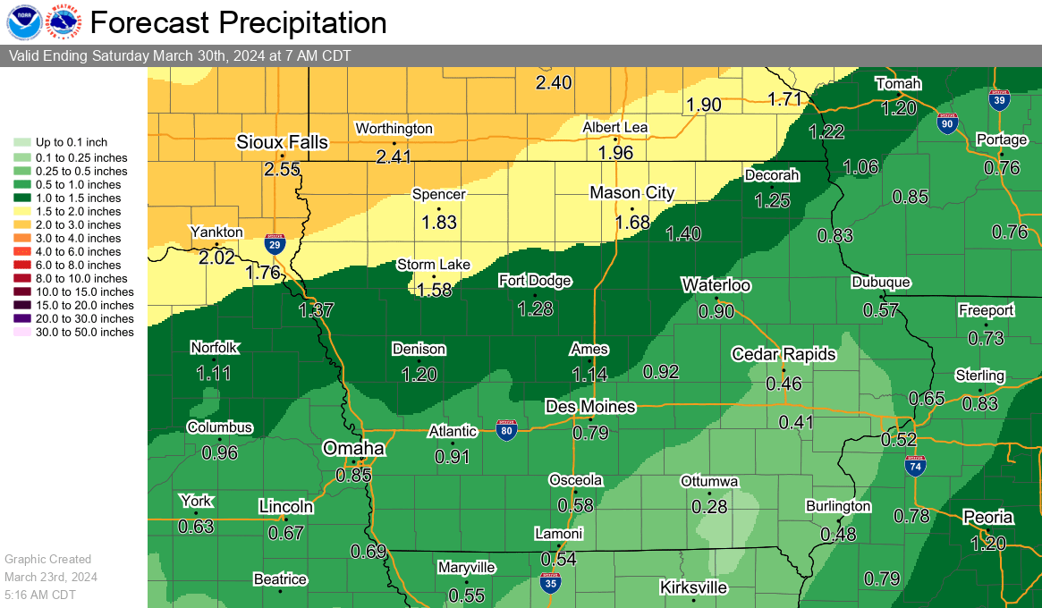
Another round of precipitation is on the way after many local communities received a mix of snow, sleet, and rain Friday. While many rain gauges were lower than a quarter-inch, much needed moisture fell in multiple forms. More substantial rainfall is possible starting late tonight and continuing periodically through Monday. Snowfall is expected to mainly impact the northern third of the state and beyond into the upper Midwest, making travel that direction hazardous. Locally, rainfall amounts between ½” to an inch will be common, with more possible depending on the final track of the storm. Temperatures will remain mainly cooler in the 40s for the exception of Monday, when a brief warmup toward 60 is a possibility before a cooldown immediately follows.