
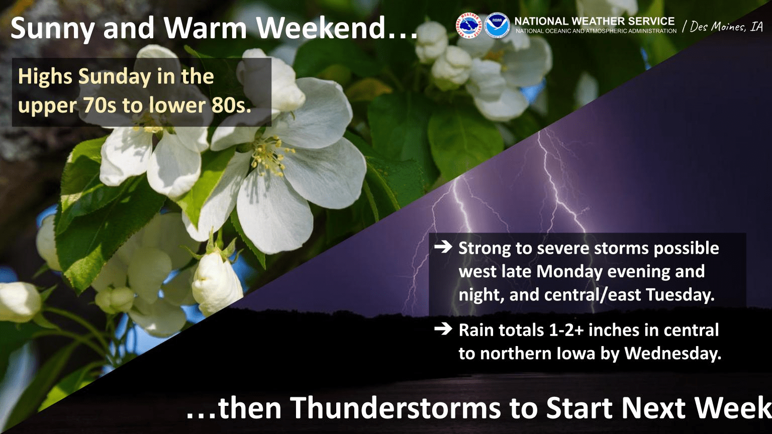
Multiple rounds of severe weather are possible Monday and Tuesday. The National Weather Service Storm Prediction Center has issued a slight risk for thunderstorms to include large hail, damaging winds, and possibly isolated tornadoes. The first round is possible late in the evening to overnight Monday, and again during the day Tuesday. Many locations could receive between 1/2 to 1 1/2 inches of rainfall, and possibly more depending on the track of storms. Daytime highs in the 80s continue through Monday evening, before a gradual cooldown back into the 50s by Wednesday. The KNIA/KRLS Severe Weather Action Team is on the air for live coverage for any severe thunderstorm or tornado warning for Marion and Warren Counties.