
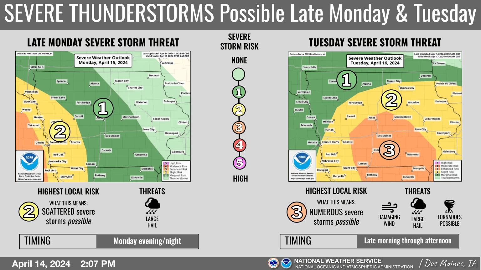
Local weather will turn much more active by tonight and through Tuesday when periodic thunderstorms are expected. Some of these may be severe at times late Monday, with large hail the primary severe weather threat during that possible round.
Additional thunderstorms are then anticipated on Tuesday, when numerous severe storms will be possible locally. Large hail, damaging wind, and some tornadoes will all be possible at times. Although confidence in details and timing is low at this time, the most favored window for severe weather Tuesday would likely be during the afternoon. With this being the first significant potential for widespread severe weather this season, it would be a good idea to ensure having a severe weather plan in place with multiple ways to receive severe weather warnings and have safe shelter identified nearby.
The KNIA/KRLS Severe Weather Action Team is on the air for any severe thunderstorm or tornado warning for Marion and Warren Counties.