
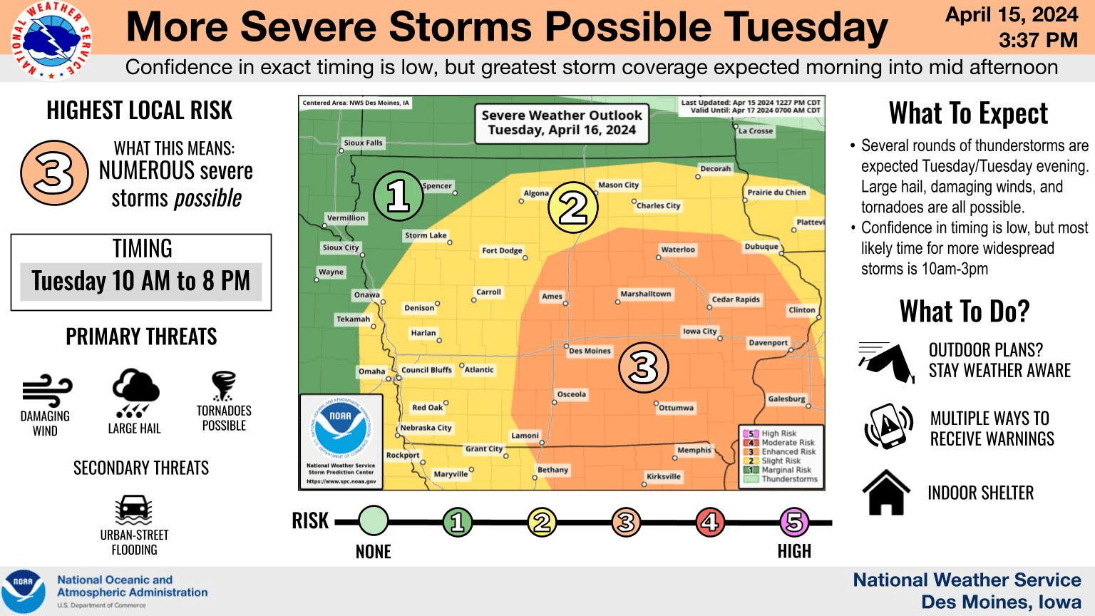
Numerous severe thunderstorms are possible across the region today. According to the National Weather Service Storm Prediction Center, south central Iowa is under an enhanced risk for potentially extreme hail and multiple tornadoes. The most likely time for severe activity will be late morning into mid-afternoon. Additionally, some locations may receive moderate to heavy rainfall, depending on the track of the storm system — with many rain gauges expected to climb to at least 1/2 an inch.
The KNIA/KRLS Severe Weather Action Team provides live on-air coverage of any severe thunderstorm or tornado warning for Marion and Warren Counties — which also is available with online streaming and the KNIA/KRLS mobile app.