
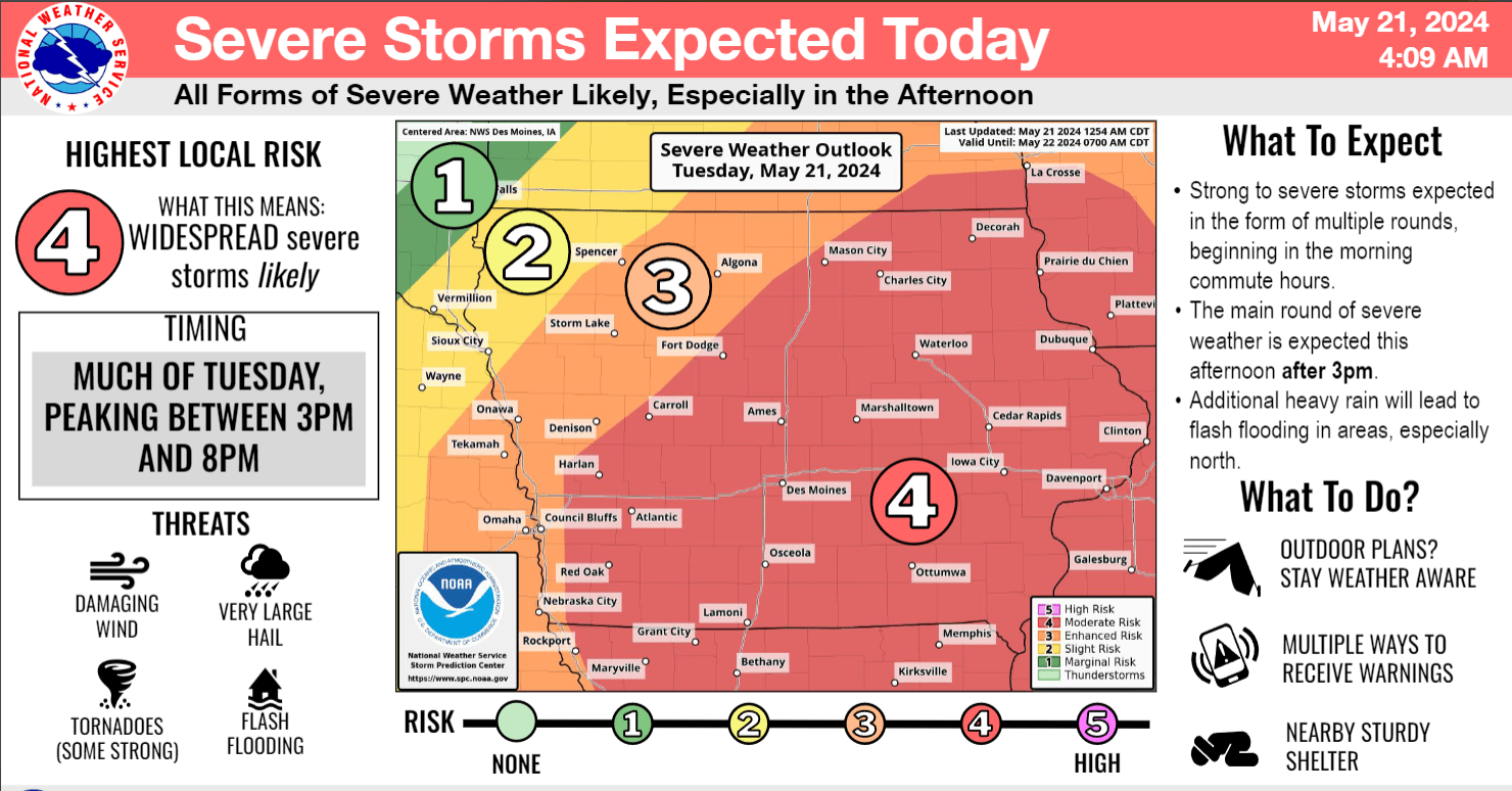
A major severe weather event is brewing across south central Iowa. The National Weather Service Storm Prediction Center has most of the state under a moderate risk, or the fourth highest on its scale for severe weather. Extremely large hail, winds over 80 MPH, and multiple tornadoes are expected with multiple rounds of severe weather today, primarily this afternoon and early evening. Flash flooding also remains a concern, and several counties along Interstate 80 are being impacted this morning. Those with outdoor plans should make sure they know where the nearest storm shelter is located. Widespread damage across central Iowa is possible today, and multiple warnings are expected. The KNIA/KRLS Severe Weather Action Team is on the air for any severe thunderstorm or tornado warning for Marion and Warren Counties.