
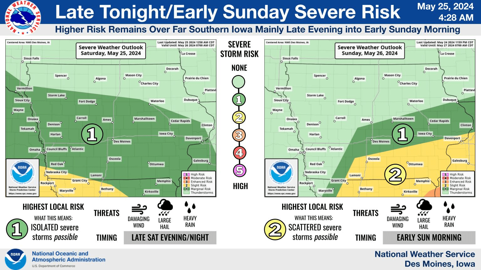
An active weather pattern may continue into early Sunday morning, according to the National Weather Service. A slight risk for severe weather is in place across the region, with the favored area for damaging wind and hail over southern Iowa tonight and early Sunday. An additional threat will be flash flooding, as an additional 1/2″ to inch of rain could fall by Sunday afternoon. Many locations have seen four to seven inches of precipitation since last weekend. The KNIA/KRLS Severe Weather Action Team is on the air for any severe thunderstorm or tornado warning for Marion and Warren Counties.