
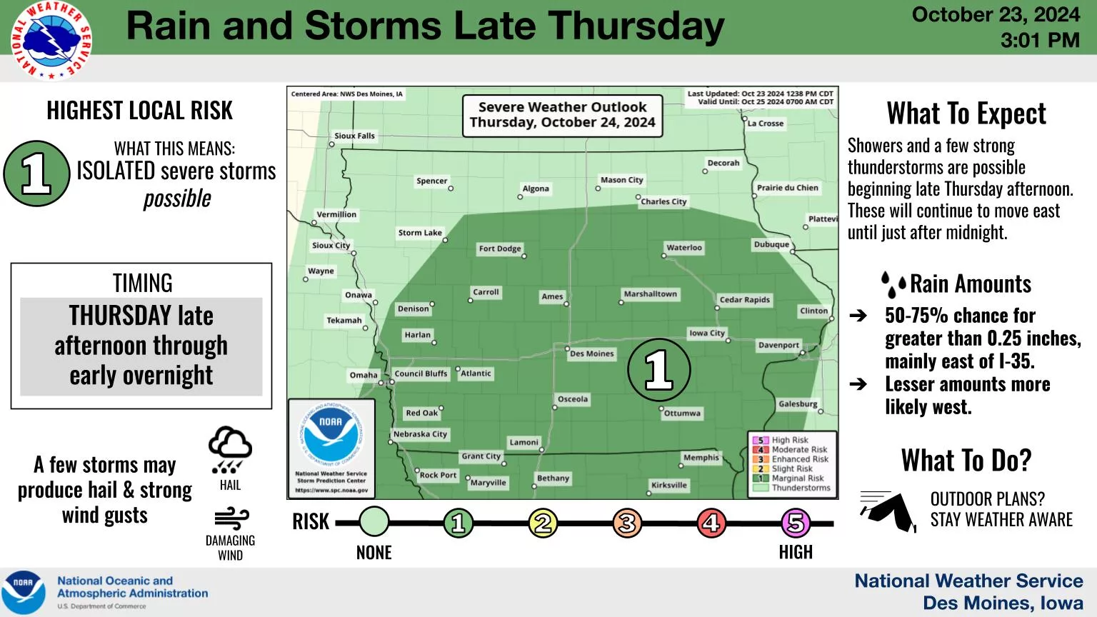
A round of potential thunderstorms could bring a burst of heavy rainfall and small hail this evening. After many locations received below a 1/4″ of precipitation early Tuesday morning, much heavier rain could be in store for many with a line of storms expected to develop primarily this evening locally. The National Weather Service Storm Prediction Center has issued a marginal risk for severe weather, with hail the primary threat. Widespread rainfall amounts a 1/2″ to 3/4″ remain a possibility, especially east of I-35 and along and south of I-80. This will kick off a topsy-turvy forecast with afternoon highs ranging between 60 and 80 degrees expected the next several days.