
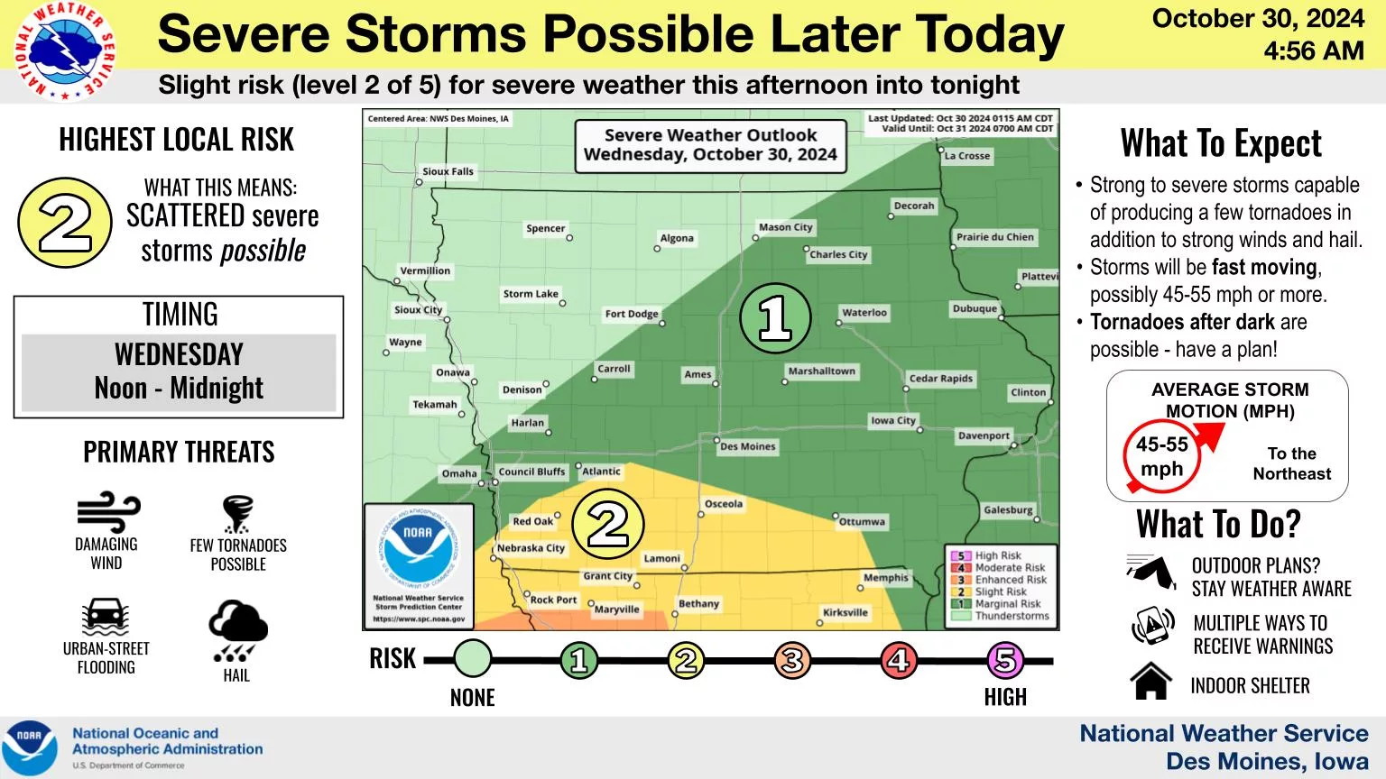
Thunderstorms are expected to impact the region and bring potentially heavy rainfall later today across south central Iowa.
The National Weather Service Storm Prediction Center has issued a slight risk for severe weather today.
Several rounds of showers and embedded thunderstorms are expected to begin locally by mid-afternoon and continue periodically through late this evening. Some of those could be severe, with gusty winds the primary threat.
Moderate to heavy rainfall is also a possibility, with widespread rainfall amounts approaching at least an inch in many communities.
Stay tuned to KNIA/KRLS for updates.