
Two more rounds of winter precipitation may impact travel through Saturday, and much colder air will return and stay in place for several days.
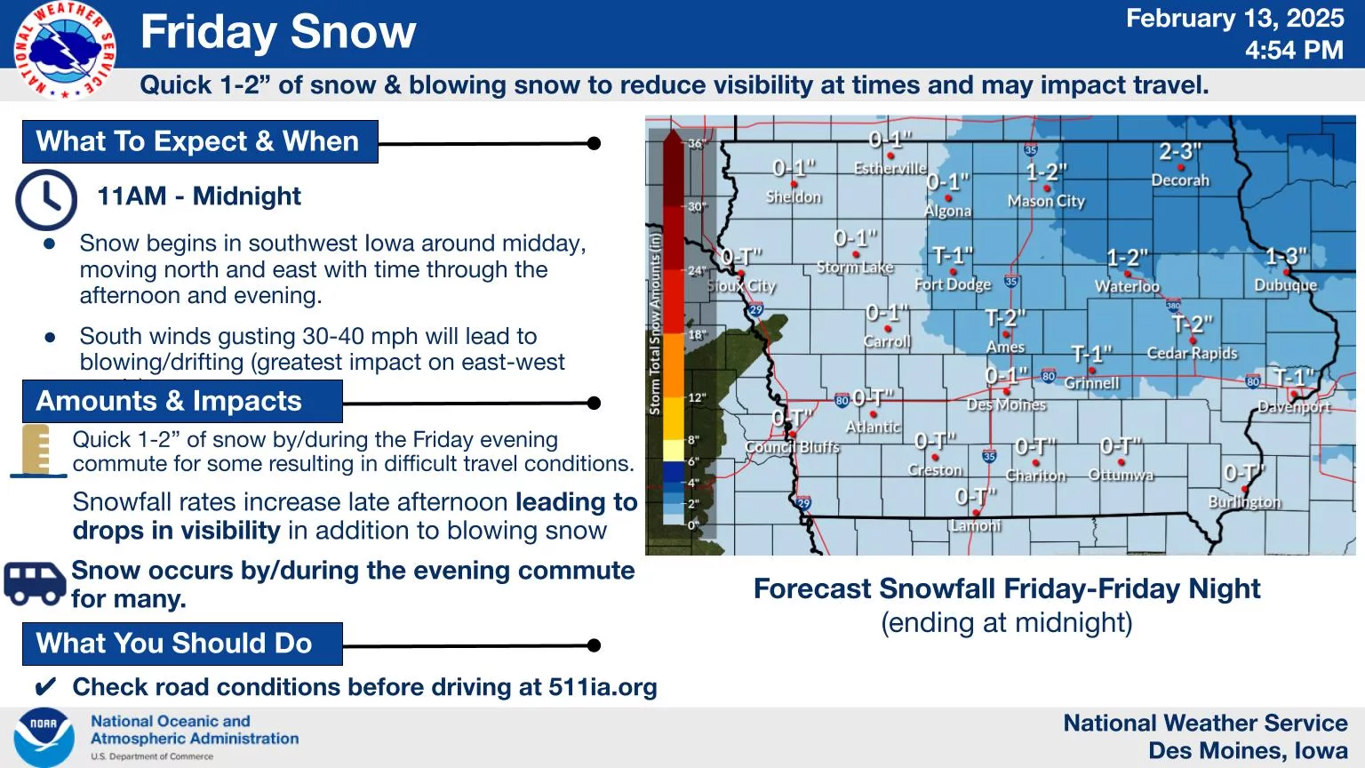
According to the National Weather Service, a quick burst of snow is possible later today that will also come with gusty winds up to 35-40 MPH. Those conditions could cause travel issues, even as accumulations will remain low locally. The timing of this period of snow may impact the evening commute and trip home from school.
A second round of snowfall on Saturday may have bigger impacts, although that has not been set. Light snow is expected on a widespread basis, but a narrow band of four-or-more inches is possible in isolated locations. Windy conditions will continue, so even light accumulations will have some impact on travel.
This will all be followed by a return of arctic air in the region. Wind chill values below zero will remain in place for several days starting overnight Saturday into Thursday next week. Some of those will approach 20 below, which can cause frostbite in as little as 30 minutes without precautions.