
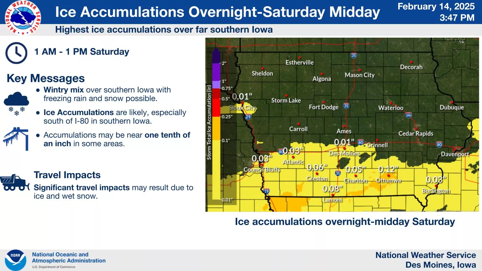
More accumulating snowfall is expected today. Locally, there may be a wintry mix with freezing rain before transitioning to snow. Travel will continue to be impacted through Saturday with additional new snow, blowing snow, and falling temperatures. Plan for slick travel and reduced visibilities at times. Ice accumulations are likely, especially south of I-80 in southern Iowa. Accumulations may reach up to one tenth of an inch. Significant impacts to travel may result from the light icing followed by wet snow. Much colder air will impact the region starting Sunday morning, with wind chills likely to stay well below zero through most of next week.