
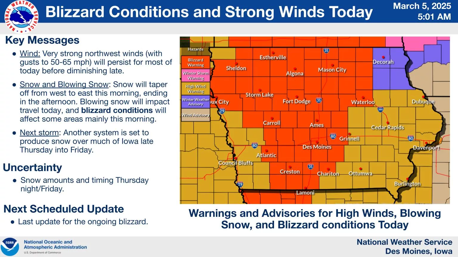
Even as snow tapers off today in the region, wind gusts up to 60 MPH remain possible through this evening. According to the National Weather Service, travel conditions will be at their worst locally until early this afternoon, especially on roads that may have snow drifts from the morning, and those in rural, open areas. A brief warmup tomorrow will be followed by more potential winter precipitation starting late Thursday night and continuing into Friday morning, according to the National Weather Service. Accumulations in south central Iowa will be generally lighter and from a trace to two inches of snow.