
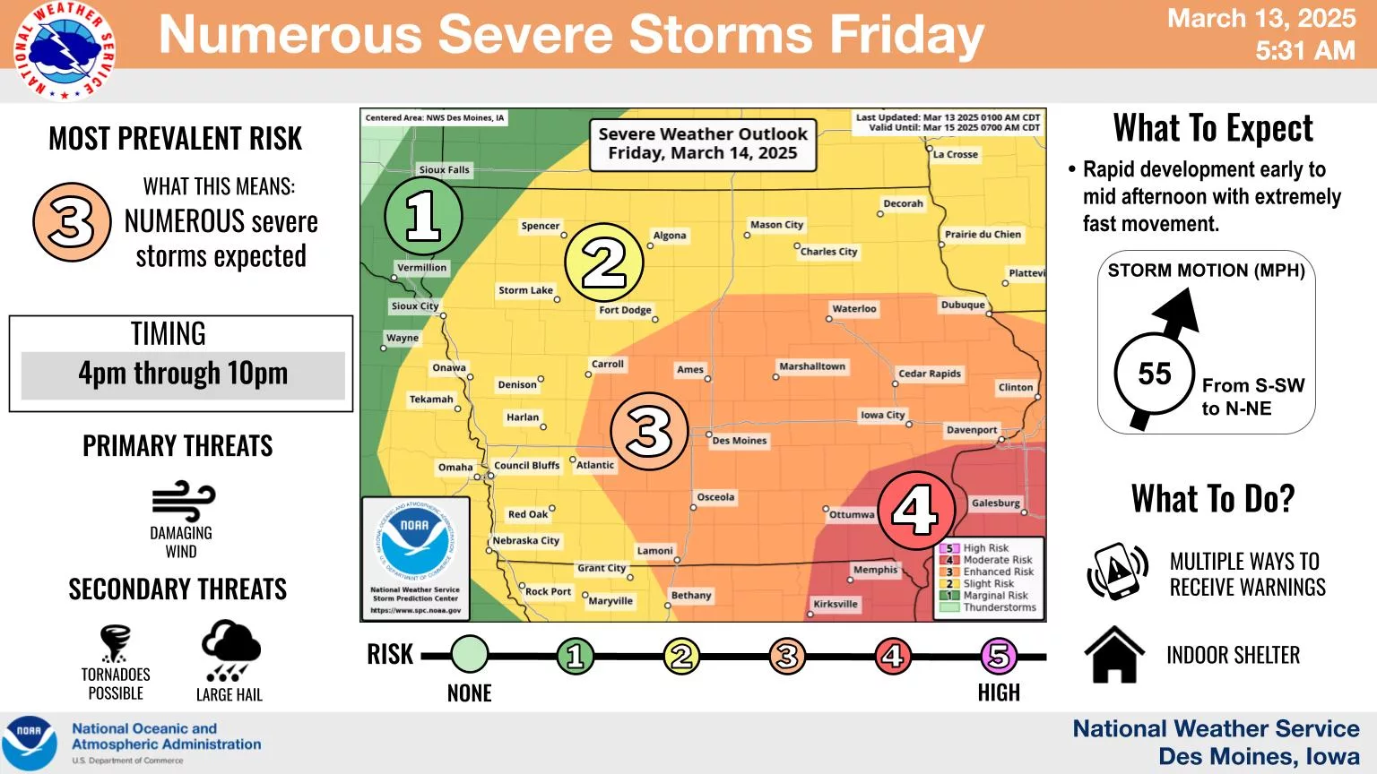
A strong low pressure system is expected to produce a line of severe thunderstorms as it moves through the state Friday afternoon and evening. The most likely timing for storms across central Iowa should be between 4pm and 10pm. Damaging winds will be the primary threat, with large hail and a few tornadoes also possible. Some storms may produce wind gusts in excess of 70 mph. The greatest potential for severe weather will be over central and far southeast Iowa where elevated (3/5) or moderate (4/5) risk levels exist. Gusty SSE winds will also occur outside of storms, with gusts of 35 to approaching 50 mph will be possible. The KNIA/KRLS Severe Weather Action Team is on the air with live coverage for any severe thunderstorm or tornado warning for Marion, Warren, and Jasper Counties.