
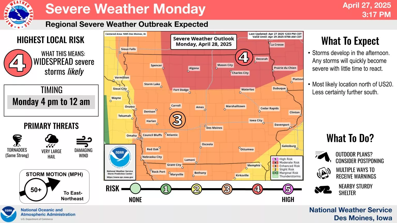
A widespread, large hail event remains the main threat on Monday as a moderate risk–or four out of five on the National Weather Service Storm Prediction Center’s severe weather scale, is in place.
While strong winds and tornadoes are also concerns — especially along and north of Interstate 80, the highest chance of damaging impact in south central Iowa appears to be large hail in excess of 2″ in diameter in several locations.
Many of the storms could be scattered in nature. Regardless, multiple warnings are expected to be issued and two rounds of severe weather are possible, starting in the early afternoon and returning again much later in the evening.
KNIA/KRLS provides live updates and on-air coverage of any severe thunderstorm or tornado warning for Marion, Warren, and Jasper Counties.