
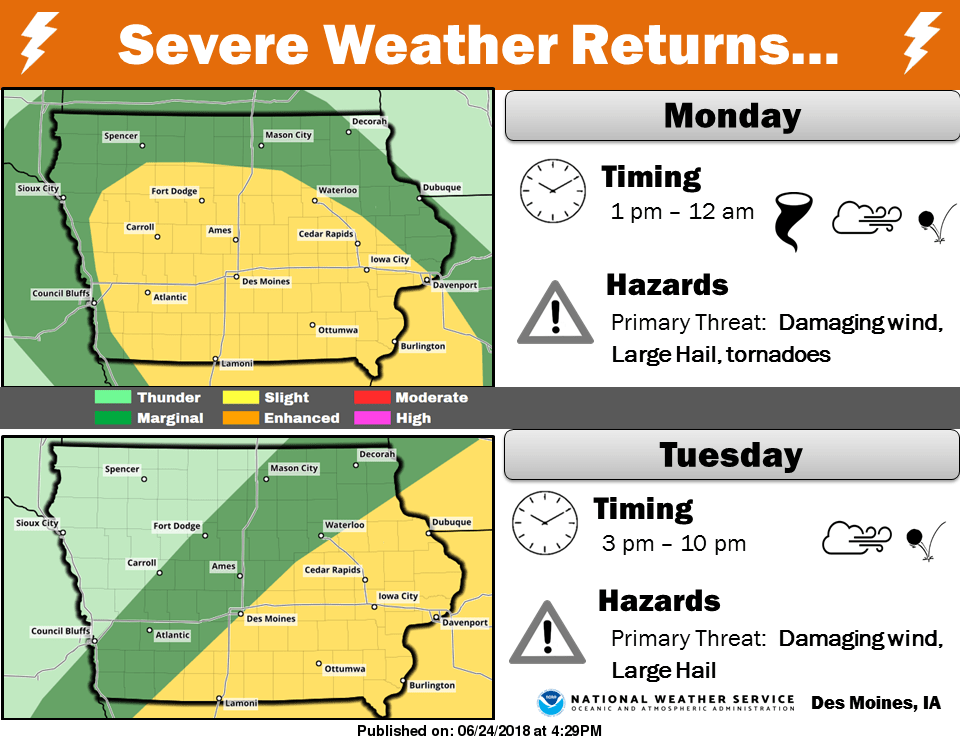
After numerous rounds of rainfall dropped over most of the region over the past week, more heavy rainfall and strong storms are possible to begin this week.
According to the National Weather Service, up to 2” of precipitation may fall over most over South Central Iowa by Tuesday evening, with more possible depending on the track of thunderstorms. Chances for strong to severe thunderstorms increase during the day today and tomorrow, with a slight risk issued by the National Weather Service Storm Prediction Center. Large hail and damaging winds will be the primary threats.
Last week, between 1.5” to 3” of rain fell throughout most of Marion County, including three inches recorded at Lake Red Rock, just over 2.3” in Pella, and over 1.6” at the Des Moines River near Tracy.
Much hotter temperatures are expected Thursday through Saturday, with afternoon highs in the low 90s and heat index values approaching 100 degrees.
Stay tuned to KNIA/KRLS for the latest weather information.
Sunday rain totals:
Lake Red Rock – 1.53”
Pella – .59”
Des Moines River near Swan – .43”