
Two rounds of severe weather have impacted Warren County on two different early morning warnings.
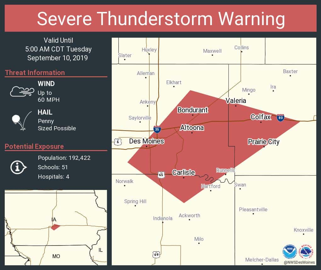
A severe thunderstorm struck the western portion of Warren County early Monday and Tuesday morning, prompting KNIA/KRLS Severe Weather Action Team coverage for the second morning in a row. A warning was issued at approximately 4am for portions of Warren, Jasper, and Polk Counties. Live coverage of the storm was on with three staff members and Weatherology Meteorologists, with the main threat being 60mph winds. The warning was originally issued to be in effect until 5am, but gradually slowed down and was called off around 4:20am.
According to the National Weather Service, an active pattern will continue through the week bringing on and off storm chances today through Thursday. Warmer and more humid conditions are also expected. Some strong storms will be possible today and tomorrow with hail and gusty winds the main severe threats. Locally heavy rain will be possible through the week as well. A cold front will move through the state Thursday which will bring cooler temperatures for Friday into the weekend. The one to count on for severe weather information is KNIA/KRLS.