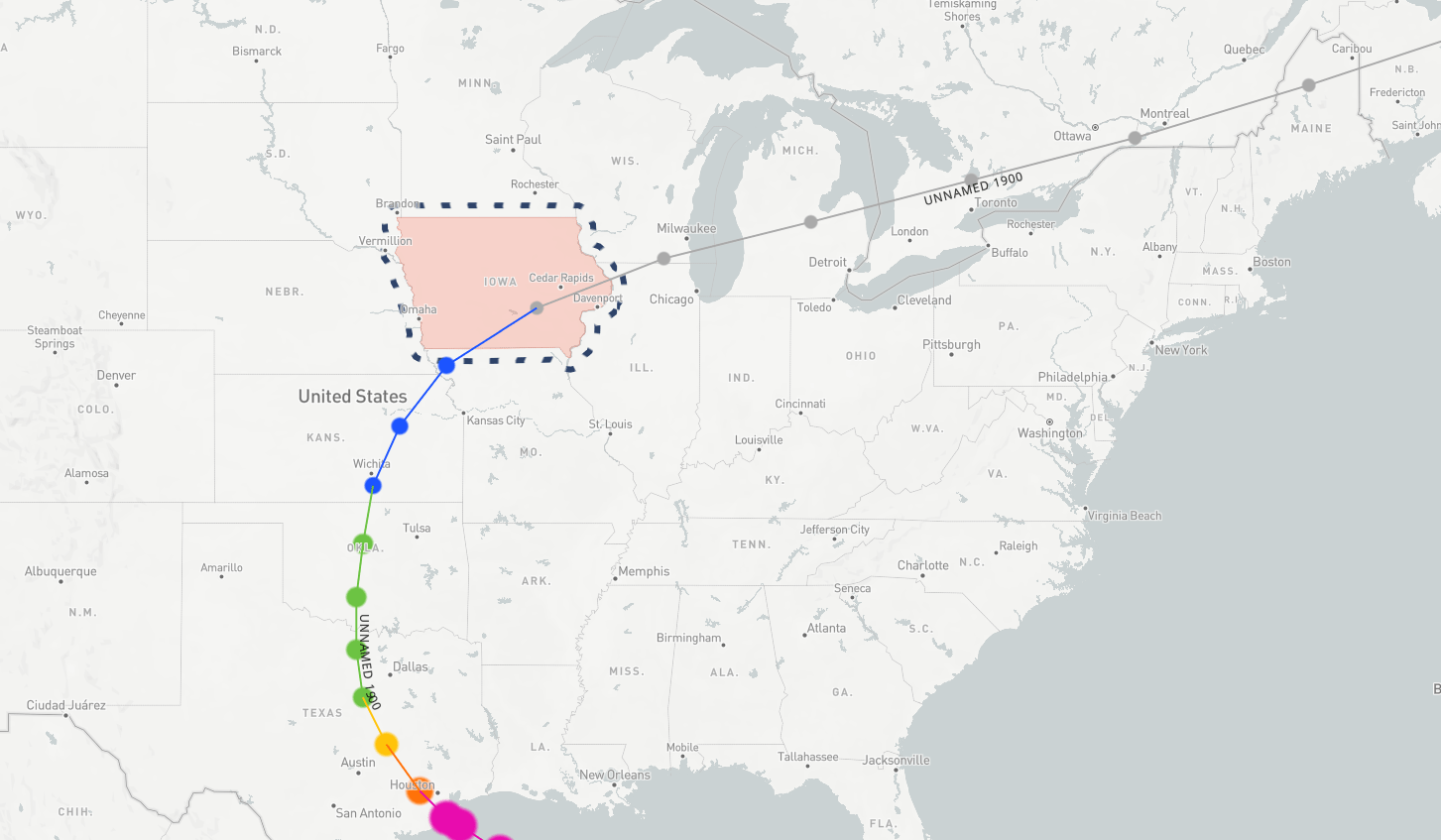
National Weather Service Map of the "Great Storm of 1900"
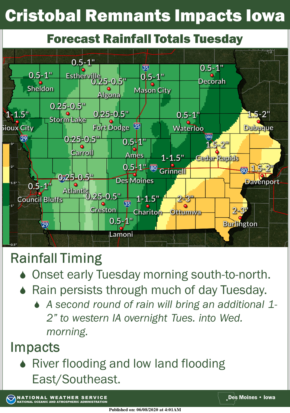
On Tuesday, a rare weather event will take place as portions of an active tropical storm system will impact Iowa.
Tropical Depression Cristobal will bring heavy rain to mainly the eastern half of the state, with precipitation falling across most of Iowa Tuesday and Wednesday. While the center of the storm is expected to pass over the far eastern part of the state, the brunt of moisture will drop to its west, which includes Marion and Warren Counties, and other parts of south central Iowa — with up to two inches of rain possible locally by Wednesday evening, and possibly more depending on the track of the main system and development of additional thunderstorms.
According to the National Weather Service, only once in recorded weather history has a storm still classified as tropical in nature passed over the state, as the remnants of the devastating Galveston hurricane of 1900 moved through Iowa just days after the deadliest natural disaster in the history of the United States made landfall in eastern Texas nearly 120 years ago.
Historical weather records indicate that the storm was still strong enough to be a tropical depression, with the center of the low pressure system estimated to have passed over Leighton. The storm strengthened over land over the next several days, causing damage in the Great Lakes region and northeast United States, and remained an extratropical system until it finally dissipated over the northern Atlantic Ocean.


