
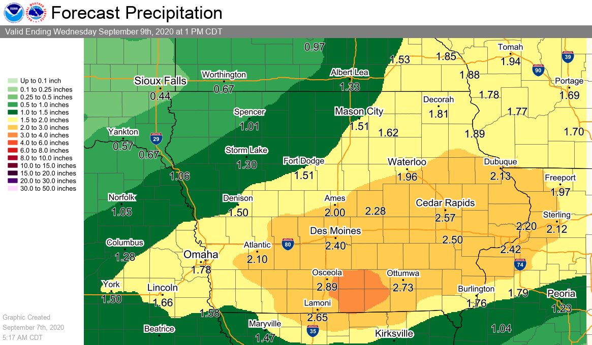
Much needed rain is expected across south central Iowa this week, but with it, potentially record breaking cool air that feels a lot more like late October than early September.
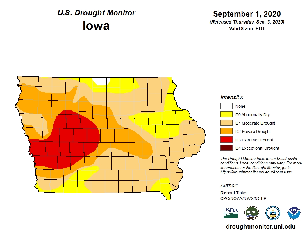
According to the National Weather Service, widespread precipitation between 1-3 inches is expected to start overnight tonight and continue through Wednesday morning, with higher amounts possible in many locations by the end of the week. The precipitation comes when all of south central Iowa is in moderate to severe drought conditions.
As the rain comes in, so will cooler temperatures that could break several records in Marion County. Typically, daytime highs are in the upper 70s and overnight lows in the upper 50s — but high temperatures will only reach the low-to-mid 50s Tuesday and Wednesday and stay in the low to mid 40s overnight. Here are the records for those days:
September 9th
Record Lowest “High” – 58 in 2008
Record Low – 41 in 1995
September 10th
Record Lowest “High” – 57 in 1924
Record Low – 40 in 1940